
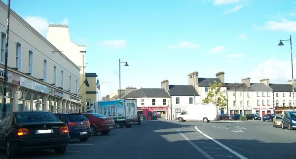
Ballaghaderreen (Irish: Bealach an Doirín, ‘the way of the little oak’) is a working market town in the north-west corner of County Roscommon, close to the Mayo and Sligo borders. It is a service centre rather than a tourist set-piece, with a population of 2,387 at the 2022 census. Come for the cathedral, the town’s story and the surrounding countryside; the list of formal attractions is short, and that’s the honest measure of the place.
Bockagh Hill, a short drive from the town, is topped by a cross put up for Pope John Paul II’s 1979 visit to Ireland. It is a local landmark, but we cannot point you to a confirmed public route up it. For hills and farmland, use confirmed routes, ask locally and respect signs.
The cathedral
The Cathedral of the Annunciation and St Nathy, seat of the Roman Catholic Diocese of Achonry, is the building you’ll see first: a Gothic stone church whose tower and spire are visible for miles across the flat surrounding land. It was commissioned in 1855 and opened in 1860; the tower came later, in 1912. Inside, look up. The nave has a timbered ceiling, there are paintings of the Annunciation, and along the chancel roof angels carry verses from the Benedicite. It remains a working church, so check the parish for services and visitor access before you go.
On the water
The Lung River runs less than a mile from the town centre and is part of a system linking local lakes. Three kilometres out, Lough Gara is a separate visit, known locally for coarse fishing and for bog and lakeshore walking around it. Check local access, permissions and fishery rules before going out, as we have not confirmed current angling arrangements, platforms or licence requirements.
Golf
Ballaghaderreen Golf Club is a 9-hole parkland course about 5km west of town, with mature trees lining several holes. Contact the club about green fees, booking and any competition days when the course is closed to visitors.
The Mayo question
Ballaghaderreen grew as a fairs and market town from the 1700s, on the mail-coach road between Ballina and Longford; by the mid-19th century it had a courthouse, a market house and an infantry barracks. It was part of County Mayo until 1899, when the Local Government (Ireland) Act 1898 moved it to Roscommon. The town has never entirely accepted the transfer: its Gaelic football club retains its Mayo affiliation and still plays in the Mayo football championship, not the Roscommon one.
The town’s other modern claim came in 2018, when it won a People of the Year Award for the welcome it gave hundreds of Syrian refugees housed at a reception centre here from 2017.
Around town
The town has a long tradition of weekly market trading along the main street, but check locally for current market days before timing a visit around one. For something quieter, Friends of the Fairgreen is a community garden where locals grow vegetables and flowers, reached by the Charlestown Road entrance into Duffy’s SuperValu.
Getting there and around
Since the N5 bypass opened in 2014, through-traffic on the Dublin–Castlebar road skirts the town to the north rather than running through it. Check Transport for Ireland for current bus services and the return journey, as timetables change. The nearest railway stations are Castlerea (21 km) and Boyle (26 km), and Ireland West Airport (Knock) is about 15 km west. Look for signed public car parks and observe local parking restrictions near the cathedral and square.
Nearby
The Douglas Hyde Centre, on the birthplace of Ireland’s first president, is about ten minutes’ drive. Further out lie the 12th-century Cistercian ruins of Boyle Abbey, Lough Key Forest Park and the town of Castlerea, all within half an hour.