
Overview
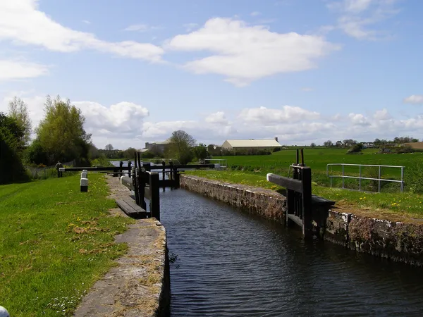
Ballyellen Upper Lock is part of the Barrow Navigation and sits beside the Barrow Way, the towpath trail that runs along the canalised River Barrow. It lies just north – upstream – of Goresbridge in County Carlow, where there are two Ballyellen locks: this upper one above the bridge and a lower one below it. There’s no visitor centre and nothing is ticketed. The appeal is the towpath, the water and a working piece of 18th-century engineering.
See the gates from the Barrow Way towpath. Stay on the public route and keep dogs on short leads. Give boats room to manoeuvre and keep clear of the lock gates.
Engineering and industrial heritage
The Barrow Navigation was first proposed in 1703, with work beginning under the engineer Thomas Omer in 1761. In time a chain of lateral canals and 23 locks connected Carlow, Bagenalstown and Graiguenamanagh down to Waterford Harbour. Commercial barges worked the river into the 1950s; the last of them ran in 1959, seen off by silting and by lorries and rail.
Beside the upper lock, a corn mill was built in 1789 with a malt house attached; by the middle of the 19th century the site had turned to a limestone quarry. The weir and mill race here once fed Duninga mill downstream, a big operation faced in cut stone to look like a medieval castle. The lock itself is a good place to watch the mechanics of the river: the raised toothed racks beside the gates show which sluices are open.
Townland history
The townlands of Ballyellen and Tomdarragh cover about 1.5 square miles on the Carlow–Kilkenny border. The name most likely comes from Alan Beg, a 13th-century landowner recorded as granting lands toward the building of nearby Duiske Abbey at Graiguenamanagh. Scattered through the surrounding fields are a standing stone, a ringfort, a bawn, the lines of an old field system and the ruins of a medieval church – the marks of a long-settled corner of the county. These are in private fields, so look from the public route.
Walking and cycling
The towpath runs from Goresbridge bridge past the lock and on south along the Barrow. It’s mostly level, with the odd uneven patch near the gates and bridges, which makes it good for walkers and cyclists. Check the Barrow Way page for the current state of the route. Further down at Clashganny, a loop leaves the towpath and climbs a forest track through birch woodland past an old mass rock, if you fancy swapping the river for the trees for a while.
Wildlife and paddling

The Barrow’s floodplain is good for birds and mammals: grey herons and kingfishers along the water, otters on a quiet morning, and songbirds and the odd hunting kestrel over the woods.
If you plan to navigate the river, check Waterways Ireland’s notice for the Barrow. It lists shallow sections and contact details for the Ballyellen locks. The Barrow rises fast after heavy rain, and high flows make the weirs and lock approaches dangerous and cut bridge clearance. Check the latest notices and the Met Éireann forecast, and turn back from flooded towpath sections.
Nearby stops
Combine the lock with the Clashganny Forest and Historic Lock downstream, the medieval streets and Duiske Abbey at Graiguenamanagh, or a wander round Bagenalstown. At Goresbridge itself, the long stone road bridge over the Barrow is worth a pause, and the towpath carries on past the 16th-century Black Castle further up the river.