
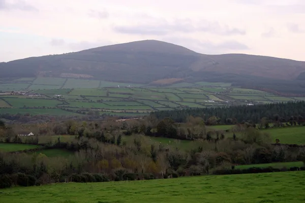
Overview
Brandon Hill rises south of Graiguenamanagh above the River Barrow. At 515 m, it is the highest point in County Kilkenny. From the summit, marked by a metal cross and a trig pillar, the view in clear weather runs to Hook Head lighthouse in the south, the Blackstairs Mountains to the north-east, the Comeraghs to the south-west and the whole length of the Barrow Valley below. The walk up climbs from shaded forest onto open, heather-and-bracken slopes grazed by sheep.
The Brandon Hill Loop
Sport Ireland grades the 15.7 km loop strenuous. Start at the Outdoor Hub in Graiguenamanagh and follow the purple arrows. The route winds up through Gorlough Wood, skirts Ballinvarry Hill and climbs green roadway to the top before descending back to town. The full loop is a proper half-day, mostly on forest track and country road. Forest tracks are good underfoot; the open hillside turns muddy and soft after rain.
Use the published map, wear boots for rough ground and check the forecast before setting out. Stay on the signed route and leave forest gates and farm entrances clear.
History and folklore
The hill has been worked and walked for thousands of years. Archaeological survey has found Neolithic cairns, field systems and a large ritual enclosure across the slopes. From the medieval period, two Norman moated sites near Ballyogan are read as agricultural granges, most likely tied to Duiske Abbey down in Graiguenamanagh. Local lore keeps a headless horseman abroad on the Inistioge side of the hill.
Gorlough Wood is the quieter half of the day: a 20th-century plantation of Sitka spruce and pine grown around older native stands, a corridor for birds like the willow warbler and crossbill, with bluebells in spring and heather colouring the open ground from July into September.
Practical Information
- Waymarking and maps: purple arrows mark the loop. Use the published route map and download an offline map before you go, as signal can be patchy on the upper slopes and the path fades on the open hill.
- What to bring: grippy footwear and waterproofs year-round. There are no facilities on the route, and cloud can drop over the top fast.
- Season: walkable year-round, with heather and autumn colour the highlights. Winter is muddy and exposed.
- Parking, dogs and buses: check Coillte’s Brandon Hill page and the Discover Ireland route page for current arrangements before you go.
Nearby Attractions
Down in the valley, Graiguenamanagh has the medieval Duiske Abbey, a fine bridge over the River Barrow, and pubs and cafés for afterwards. For walkers stringing days together, both the South Leinster Way and the Barrow Way pass through, making the town a handy base.