
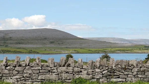
Cappanwalla rises above the north Clare coast near Ballyvaughan. The draw here is the limestone and the view, not the effort of a climb. From the published Black Head Loop you can see how the slopes of the Burren step down toward Galway Bay. The trail skirts Cappanwalla’s shoulder, so follow the marked loop and leave the hill’s upper slopes and the adjoining farmland undisturbed.
Walking the Black Head Loop
The Black Head Loop is a serious undertaking, waymarked in purple and yellow. Start at the trail board at Fanore Beach car park. From Fanore the route climbs to the stone stile at Gleninagh Pass, follows a sandy roadway along Cappanwalla’s shoulder into the Feenagh Valley, passes Caher an Ard Rois, skirts the slopes of Slieve Elva and descends through Ballelly to rejoin the R477 at the coast.
Visit Clare lists the loop at 26 km and five to six hours. Allow a full day, and check the route description and map before setting out. Visit Clare also publishes a two-page map card for the route. Start early, carry a charged phone and a backup for navigation, and treat it as a full day rather than an afternoon.
There are rough limestone sections and stretches on public roads. The limestone gets genuinely slippery after rain and the ground is uneven, so wear boots with a decent grip and bring water, layers and a map. Stay on the waymarked route and follow any access or livestock notices on the day.
The limestone and what grows on it
The hill is Carboniferous limestone, laid down more than 350 million years ago and scoured bare by ice during the last glaciation, which left the pavements, grikes and clints that define the whole Burren. The conditions are harsh – alkaline, free-draining, short on surface water – and yet the plant life is unusually mixed. Arctic-alpine mountain avens grow within a few feet of Mediterranean spring gentians, and late spring adds bluebells and rock-roses between the stones. Late May through August is the time to see the thin soils fill with wildflowers. At the northern foot of the hill, Tobercornan holy well has been a place of local devotion for generations.
Shorter Burren walks
For a shorter outing, start at the Burren National Park Information Point in Corofin. Staff can help you choose among the park’s marked walks, some of which take less than an hour. The park runs a shuttle from Corofin to the trailhead from May to September.
Getting there and practical notes
- Maps: Discovery Map 51 / OSi sheet 051 (Clare & Galway) covers the area.
- Starting point: the Fanore Beach car park, where the Black Head Loop begins.
- Gear: Waterproofs, water and a map. The exposed slopes are wind-swept and cold even when the coast below is mild.
- Getting here: From Ennis, take the N85, join the R476 and follow the R477 to Fanore. Check the current bus options from Ennis to Doolin before you travel; you will need a taxi or other transport for the last stretch to Fanore.
Nearby
- Aillwee Cave – a limestone cave system near Ballyvaughan.
- Cliffs of Moher – sea cliffs a drive down the coast.
- Burren Way – the long-distance route that threads the wider Burren.
- Fanore – the coastal village and beach where the Black Head Loop begins.