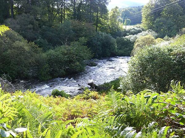
Lakes, Rivers & Waterfalls in County Wicklow

Most of the water on this page lies along one corridor. The R759 over the Sally Gap and the R755 south through Roundwood and Laragh take in Lough Tay, the J.B. Malone Memorial viewpoint above it, Lough Dan under Luggala and Glenmacnass Waterfall at the head of its valley, so several of these can be seen in one afternoon’s driving. The same caveat repeats along the way: Lough Tay, Lough Dan and the Luggala estate are private, with no public right of way to the shore, so the view from the road or from the Wicklow Way is the whole visit.

Rain and water level change what you get. Glenmacnass falls 80 metres in three staggered drops and reads as a wide silver ribbon rather than a plunge, so it repays a trip after heavy rain. Vartry Reservoir at Roundwood goes the other way; in a dry summer the stonework of a submerged bridge reappears on the Lower Trail. Vartry also has the easiest walking here, with three free waymarked loops running from 3 km to 7.2 km.

The rest are spread out. Blessington’s lakes sit on the western side of the mountains over a valley flooded in the 1930s, with a flat Greenway along the southern shore to Russborough House. Annamoe, ten minutes north of Glendalough, has a four-acre trout lake but no pub or shop. Lough Ouler is the hardest of them, unmarked and boggy, its heart shape only showing from Tonelagee above.

Where to start

  1. Lough Tay – the Guinness Lake Roundwood

    Dark water and an imported white strand below the granite cliffs of Luggala, seen from the Sally Gap road because the shore itself is private.

  2. Lough Dan – Wicklow's secluded ribbon lake Roundwood

    Boomerang-shaped ribbon lake set deep below Luggala and Knocknacloghoge, a protected valley with privately owned land and no public right of way to the water.

  3. Glenmacnass Waterfall – an 80m cascade Laragh

    Eighty metres of water over three staggered drops at the head of a glaciated valley, free to park at and best after rain.

  4. Annamoe – bridge, woodpeckers and trout fishery Annamoe

    A crossroads village on the Avonmore with a four-acre trout lake, a 1746 humpback bridge and woods holding great spotted woodpeckers.

  5. Avonmore River – Meeting of the Waters

    Thirty kilometres from Lough Dan to the Meeting of the Waters, with the Avonmore Way tracking it through Clara Vale's semi-natural woodland.

18 of 21 shown — tap a pin for the place.

Meeting of the Waters, Wicklow, Lewis
Meeting of the Waters, Wicklow, Lewis Engraver Frederick Christian Lewis, after Thomas Sautelle Roberts / Wikimedia Commons / Public domain

Avonmore River – Meeting of the Waters

wicklow

The Avonmore runs about 30 km from Lough Dan to the Meeting of the Waters, the confluence Thomas Moore set to music in his Irish Melodies. The Avonmore Way follows it for 12 km through Clara Vale, Wicklow's largest semi-natural woodland, and Avondale's treetop walk overlooks the valley. Watch your car at the trailhead car parks – break-ins have been reported.

🌳 Outdoor
Road at the Vartry Reservoir, County Wicklow
Road at the Vartry Reservoir, County Wicklow Sarah777 / Wikimedia Commons / Public domain

Vartry Reservoir – lake walks near Roundwood

Roundwood, wicklow

Vartry Reservoir still supplies part of Dublin's drinking water, more than 160 years after its dam was built to help end the city's cholera outbreaks. The Upper Vartry loop starts at Knockraheen with views towards the Sugar Loaf and Djouce. Visit Wicklow lists the Lower Vartry Trail as closed, so check local notices before choosing a route.

🌳 Outdoor 🐕 Dogs Welcome

Questions people ask

Can you walk down to the shore at Lough Tay or Lough Dan?
No. Both lakes and the Luggala estate around them are private, with no public right of way to the water. The views come from the R759, from the J.B. Malone Memorial boardwalk and from the Wicklow Way, which passes close by.
Which of these can I visit without a hillwalk?
Vartry Reservoir near Roundwood has three easy waymarked loops, 3 km to 7.2 km. Glenmacnass is seen from the roadside, with free parking at the top of the R115, and the Blessington Greenway to Russborough House is flat and paved.
Where do most of them cluster?
Around Roundwood, Laragh and the Sally Gap. Lough Tay, the J.B. Malone Memorial, Lough Dan, Luggala, Vartry Reservoir, Annamoe and Glenmacnass all sit in that corridor. Blessington is over on the western side, and the Slaney runs south off Lugnaquilla.
When is the best time to see Glenmacnass Waterfall?
After heavy rain, when the three drops carry most water. It is a wide ribbon rather than a thundering plunge, so a dry spell leaves little to see. Walk back towards Laragh for the view; wet rock and the roadside both need care.
How hard is the walk to Lough Ouler?
Harder than it looks. The approach is unmarked and boggy and needs real navigation and settled visibility. The heart shape only reveals itself from above, so climbing Tonelagee, at 817 m, is part of the trip rather than optional.

← All things to do in County Wicklow

Book tours & tickets

Powered by GetYourGuide

We may earn a commission if you book through this link, at no extra cost to you.

Book tours, skip-the-line tickets and day trips with GetYourGuide. Free cancellation on most experiences.

See tours & tickets in County Wicklow →
Advertisement