
Overview
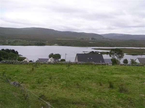
Lough Anure (Irish Loch an Iúir, ‘lake of the yew’) lies in the Rosses, the low, lake-strewn corner of north-west County Donegal north-east of Dungloe. It’s a shallow lake dotted with small islands. One of them, Trairagh, still carries a wild yew, the iúr that gave the lake its name. Water drains out of it by the River Crolly (the Gweedore River) to reach the coast at Crolly. Its shallow water hides rocks, and wind can make conditions rough. On the eastern shore is the Gaeltacht village of Loughanure, where Irish is the everyday language and where the Irish-language college Coláiste Mhuire is based.
History & Heritage
The village’s character was shaped for nearly a century by an unexpected industry. Around 1850, local women noticed a white powder in the area and recognised its potential, sparking a lime-making trade that would define Loughanure. Stone kilns, typically 12 feet in diameter and 12 feet high, were constructed throughout the village. Workers packed layers of turf and limestone into each kiln, then lit the mixture with a simple black-powder fuse made from sulphur, saltpetre and charcoal. The burn lasted around ten hours, producing quicklime that was bagged, loaded onto donkey-drawn wagons and sold within a 20-mile radius. It went on local fields, into building work, and even onto crops as frost protection.
The trade faded through the late 1930s – local accounts blame a promised grant that never came – and by the 1950s the kilns had gone cold. Their weathered stone shapes still stand across the landscape today. Coláiste Mhuire has been associated with guided heritage walks that trace these old sites, explaining the chemistry of the burn, the labour involved, and how the industry sustained the community for generations. Ask the college whether walks are running before you plan around one.
What to See & Do
- The lake and its islands – Look out over the islands, the surrounding hills and the houses strung along the shore. The island holding the original yew tree is a quiet focal point, best enjoyed from a distance. Wind can make the water rough, so do not head out on the lake without local advice and proper safety gear.
- Birdwatching – The shoreline is a good place to watch for birds, particularly during spring and autumn migration, from wherever you can see the water from public ground.
- Angling – Inland Fisheries Ireland’s Lough Anure guide lists brown trout and describes how the lake’s fishing is managed locally. Before travelling, confirm current permits, season dates and access with the fishery. Anyone planning to fish for salmon or sea trout should check Inland Fisheries Ireland’s licence and permit guidance and the current rules for this water.
- Heritage walks – Coláiste Mhuire has been linked with guided walks to the lime-kiln sites. Ask the college whether any are running; if so, they may be given in Irish with English explanations.
Getting There
Loughanure lies on the N56 between Dungloe and the wider Gweedore region. Check locally for parking and for any arrangements around the shore, and keep to public roads and signed access. Check Transport for Ireland for current bus services, as timetables change. If you plan to fish afloat, confirm boat hire directly with the operator or the fishery before you travel.
Practical Information
- Permits – Confirm current permits, season dates and access with the fishery before fishing. Do not rely on old lists of permit outlets or seasons.
- Facilities – Do not count on shops, toilets or a café at the lakeside. Dungloe is the main service town for the area.
- Seasonality – The landscape can be enjoyed year-round, but weather on this exposed coast changes quickly, so dress for it.
- Heritage walks – Check with Coláiste Mhuire for the meeting point and dates.
Nearby Attractions
- Bunbeg Harbour – A short drive north, a working harbour village with a sheltered beach, seafood and boat trips out to the islands.
- Dungloe – The main service town for the Rosses, with shops and cafés.
- Gweedore – North on the N56, the Gaeltacht heartland of west Donegal, and the way to Errigal and the Poisoned Glen at Dunlewey.
- Arranmore – The ferry from Burtonport reaches the inhabited island of Árainn Mhór.
If you do one thing here, make it the lime-kiln story rather than the fishing.