
Overview
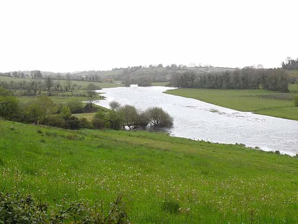
Anglers know the Annalee for its wild brown trout, in water most visitors drive straight past. The river is roughly 67 kilometres long, rising at Lough Sillan near Shercock and flowing west through Lough Tacker and past Cootehill before joining the River Erne below Butlersbridge. Its upper reaches are known as the Annagh. It drains a broad slice of north-central County Cavan, gathering the Bunnoe, Laragh, Dromore, Knappagh, Madabawn and Cavan rivers on the way. The name traces back to the townland of Annaghlee (Eanach Lao) and the old district of An Eoghanach; the Irish is Abhainn na hEoghancha.

Angling and wildlife
Inland Fisheries Ireland maps the trout stretches and access points on the Annalee. The Cavan angling guide lists a permit for the Cavan Anglers’ Club stretch upstream of Ballyhaise to Ballynallon. Depending on season and conditions, the river holds perch, pike, roach, bream and brown trout. Inland Fisheries Ireland’s guide also covers the local district clubs, Cavan, Laragh and Bunnoe, and it is worth reading before a first visit.
Permit and season rules change, so check the rules for the stretch you plan to fish with Inland Fisheries Ireland, and follow any spawning-season restrictions. Use only authorised access points and keep farm gates clear. An angling permit does not give access to other private banks or fields. The quieter, sheltered stretches are good heron water, and if you are patient and quiet you might catch an otter working the banks.
Walks and heritage
The Annalee is a slow, rural river, running by Lough Sillan and Lough Tacker and into the market town of Cootehill, where it takes in the Bunnoe and Laragh. Downstream, Butlersbridge gives you a scenic bridge crossing and a clear look at the confluence with the Erne. It is stone-wall and patchwork-field country, worked land rather than wilderness, so stay on public roads and authorised access points.
The river carries one sobering piece of local history. In September 1895, Charles Joseph Fay, a former Home Rule League MP, drowned in the Annalee after losing his way in the dark coming home from the Cootehill fair. Flow has been gauged at Butlersbridge for decades: the catchment there is 774 km², average flow about 13.7 m³/s, and the highest reading on record was 107 m³/s on 30 November 1995.
Getting there and practical tips
The river runs through private farmland, so rely on the access points shown in the Inland Fisheries Ireland guide rather than walking in from the road. The river is best reached by car. If you are travelling without one, check current public transport options before you set out.
- Permits: Check current requirements with Inland Fisheries Ireland and the Cavan Anglers’ Club; rules differ by stretch and by season.
- What to bring: Sturdy footwear for muddy banks, the IFI angling guide, and a packed lunch, as there is no shop on the bank.
- Conditions: Flow is generally steady but rises quickly after heavy rain.
Nearby stops
- Annagh Lake – calm water for a swim and a crannóg to look at, a short drive north.
- Belturbet – on the Erne, with boat trips, heritage walks and Turbet Island.
- Cavan County Museum – local finds including the Killycluggin Stone.
- Butlersbridge – a quiet village on the lower river, good for a coffee stop.
Sort your permit position with Inland Fisheries Ireland beforehand, and give yourself time to wander the drumlin country around the river. It rewards a slow day, not a quick one.