
Overview
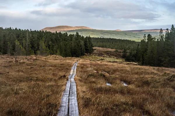
Sheskin is a remote section of the Western Way with few services and nowhere convenient to turn back – a large Coillte conifer forest laid over the blanket bog of north County Mayo, running between Ballycastle and Bellacorick. There is no habitation for miles. Coillte’s own name for it is Ireland’s ‘big sky country’, and the sky really is the point: with the ground so flat and empty, the weather overhead does all the work.
The forest itself is mostly Sitka spruce and Lodgepole pine, some of it clear-felled, threaded by forestry tracks and the Western Way. This is not a casual walk. It crosses moorland paths and forest road, and it needs a map and compass and the skill to use them. Sport Ireland’s Mayo route listing has the section maps and current notices, and it lists no dogs on the route.
Sheskin Lodge
The one built landmark on the route is a ruin. Sheskin Lodge was a hunting lodge tied to the Jameson family of whiskey fame, who used it as a shooting station out in this emptiness. It is slowly going back to the bog, walls under moss and fern. The oddest thing near it is a monkey puzzle tree, an obvious planted survivor that has no business in a landscape like this. Keep to the waymarked route, and leave the old lodge and the ground around it undisturbed.
The bog
Much of the walk skirts the Knockmoyle Sheskin Nature Reserve, an intact lowland blanket bog, designated a Ramsar wetland of international importance in 1987. Because it has largely escaped the burning and overgrazing that scarred other Mayo bogs, its plant life is unusually rich: black bog rush, bog cotton and the rare marsh saxifrage among it. The clean, wet Atlantic air suits the mosses and lichens too.
One caveat on the wilderness feel: it is no longer untouched. A wind farm has been built here, and a wide gravelled access road built for the turbines has replaced some of the old narrow path. The turbines stand against the peatland in stark contrast; whether that reads as intrusion or interest is up to you.
Walking it, and getting there
Because it is so remote, Sheskin is not for casual walkers or families with young children. Be self-sufficient:
- Navigation – phone coverage can be poor or absent across much of the forest. Carry a map and a compass, and know how to use them. Use the section maps on the Sport Ireland route listing.
- Footwear and layers – waterproof boots, proper rain gear and warm layers. The surface runs from hard wind-farm road to wet, muddy forestry track and saturated bog, and the weather turns fast.
- Supplies – there are few services on this stretch. Bring all your food and water.
- Midges – the bog breeds them on warm, still days. Bring repellent, and a head-net if you are sensitive to them.
- Dogs – the route listing shows no dogs, so leave them at home.
Plan transport for both ends, and keep to the trail and respect any forestry notices. Bus services from Ballina and Castlebar to the villages at either end can be sparse, so check current timetables, and consider a pre-arranged taxi or a two-car drop if you want to walk it one-way.
Nearby
- Wild Nephin National Park – the adjacent wilderness, with dark-sky viewing and more rugged walking.
- Aasleagh Falls – further south on the Western Way, a waterfall on the Erriff where Mayo meets Galway.
- Ballycastle – the coastal village at the northern end, and a warm meal within reach of Downpatrick Head.
Go with a map, a compass and a plan to get back. This is a fine walk, but not one to improvise.