
Overview
In the summer of 1848 the Young Irelander Thomas Francis Meagher climbed Slievenamon and “baptised” the green, white and orange tricolour in front of a large crowd gathered in the run-up to the 1848 rebellion. That is the kind of hill this is: a single mountain that carries a lot of the country’s memory on its back.
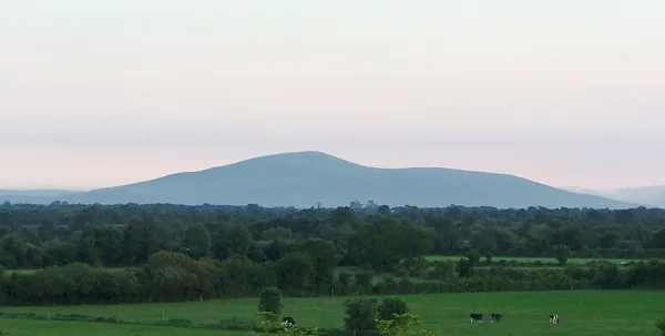
Slievenamon (Irish: Sliabh na mBan, “mountain of the women”) rises to 721 m (2,365 ft) in south-eastern County Tipperary, standing on its own above the Suir valley so that its profile is easy to pick out from Fethard, Clonmel and Carrick-on-Suir. From some angles the ridgeline is said to resemble a woman lying on her back. It is a steep, strenuous climb rather than a technical one, and from the summit cairn on a clear day you can look across to the Comeraghs, Galtees and Knockmealdowns. If you do one thing here, do the out-and-back to the summit cairn, and give it the time and the weather it needs.
History and folklore
The race of women
The mountain’s name comes from one of Ireland’s most durable legends. Many young women wished to marry the hero Fionn mac Cumhaill, so to settle it he stood atop Slievenamon and declared he would marry whichever of them won a footrace to the summit. Already in love with Gráinne, he quietly showed her a shortcut, and she duly won while the rest laboured up the open ground. The tale, gathered in 19th-century collections, fixed the mountain’s identity as Sliabh na mBan, sometimes lengthened to Sliabh na mBan bhFionn, “mountain of the fair women”.
Ancient cairns and Otherworld tales
Slievenamon is an archaeological landscape as much as a mythological one. Prehistoric monuments are said to dot the slopes, including a burial cairn on the summit, the remains of a cursus or ceremonial avenue, and on the shoulder of Sheegúna another cairn and a ruined megalithic tomb. People long read these as sídhe, fairy mounds and doors into the Otherworld, and folklore warns that damaging the stones invites a curse. Leave the cairn and the stones as you find them.
One story ties the cairns to the winning of wisdom. Fionn and his warriors were cooking a pig by the River Suir when an Otherworld figure named Cúldubh came out of a Slievenamon cairn and stole it. Fionn ran him down and killed him with a spear as he retreated, but as an Otherworld woman pulled the cairn door shut, Fionn’s thumb was caught in the frame. Sucking it to ease the pain, he took in the ancient knowledge held inside the mound, an echo of the Salmon of Knowledge and of the mountain’s role as a threshold. Another tale names one cairn as the dwelling of Bodhbh Dearg, son of the Dagda, where Fionn later married Sadhbh and fathered Oisín.
Meagher’s 1848 rally
Draped in a tricolour sash on the mountain in 1848, Meagher publicly blessed the flag he had first unveiled in Waterford months earlier, declaring his wish to “decorate these hills with the flag of my country”. The mountain’s hold on Tipperary was cemented again by Charles Kickham’s mid-19th-century song Slievenamon, a lament for exile that is still associated with Tipperary and is sung at GAA matches and local gatherings.
Walking routes
Explore Carrick-on-Suir describes the direct route from Kilcash as about 6 km with 471 m of climbing. Allow around two and a half hours for this strenuous out-and-back, with longer in poor conditions. Start from the Kilcash trailhead, park clear of farm gates and follow current signs. The ground is steep and rough, and the route crosses farmland, so keep to the established path and close gates behind you.
The out-and-back is the one most people do, and the right choice for a first visit. Other routes are not described by the official local guide, and the ground around the path is farmland, so stick to the out-and-back.
Wildlife and landscape
The lower slopes hold pockets of mixed woodland before opening into heath and rough pasture. Summer brings bell-heather and bilberry; late autumn turns the ridges rust and gold. The exposed top is good raptor country, with buzzards and peregrine falcons working the updrafts, especially through the spring and autumn migrations, and skylarks, meadow pipits and curlews across the open ground.
Practical information
Parking – There is limited trailhead parking near Kilcash. Keep gates, farm entrances and livestock access clear, and don’t block the road. If the parking is full, come back at a quieter time rather than parking on verges.
Access and dogs – The terrain is steep, rough and uneven, so it is no good for wheelchairs or pushchairs. Check local signs and access notices at the trailhead before bringing a dog, because routes cross farmland and restrictions can apply.
Navigation and safety – The mountain is exposed and the weather turns fast. Check the forecast, bring a map, waterproof boots and warm layers, and turn back if the weather closes in. In winter the paths can ice up and visibility drops. A printed walking booklet is available through the Explore Carrick-on-Suir site.
Getting there – Kilcash is a short drive from Carrick-on-Suir and Clonmel, off the N76. Check current public transport options and plan a taxi or a longer road walk for the final stretch to Kilcash.
Nearby attractions – After the descent, take in the ruins of Kilcash Castle, explore the Suir Blueway, or head for the neighbouring Devil’s Bit Mountain. For more on the legends above, see our Travel Guide to Irish Folklore and Mythology.
Check the Met Éireann forecast before you leave and carry a layer for the summit whatever the valley is doing.