
The Ballinderry holds something most Irish rivers lost a century ago: freshwater pearl mussels, an animal so intolerant of pollution that its presence is a sign of clean water. The upper reaches near Cookstown are a protected Area of Special Scientific Interest for exactly this reason.
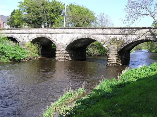
The river rises a little northwest of Pomeroy, drops fast off the Sperrins through Cookstown, and runs on for much of its course as the line between County Tyrone and County Londonderry before reaching the western corner of Lough Neagh. This is a fast-flowing spate river, not a placid lowland one. It can change level quickly after upland rain, and that matters whether you’ve come to fish it or just to look at it. At Coagh, the stone bridge in the photograph above crosses the river, which makes it an easy place to see the Ballinderry from a public route.
A river for wildlife
DAERA identifies the upper river as important for freshwater pearl mussels and records brook lamprey, otters and kingfishers. Watch from established public routes and leave the riverbed undisturbed. Water can rise after heavy rain.
Fishing
The Ballinderry is associated with the dollaghan, a large migratory brown trout of the Lough Neagh system that runs up the feeder rivers to spawn and is found in only a handful of waters. It is also known as a trout river that has picked up salmon in recent years.
Fishing here depends on exactly where you are. Check Northern Ireland’s angling rules for rod licensing and permits, and verify the fishing rights, methods and season for the precise stretch before going. Private fisheries require permission from the fishery owner. Stay on public routes unless you have permission to cross the banks. Being a spate river, it is best approached with care after rain, and catch-and-release is a good habit to protect the stocks.
Walking the banks
Set expectations here: there is no continuous waymarked riverside trail, and much of the bank runs through farmland and private estate ground. This isn’t a walk-the-whole-river destination. What you get instead are short stretches reached from Cookstown and from local routes, on generally gentle, often muddy ground. Stay on public paths, wear boots, and after wet weather expect the lower paths to be waterlogged.
For a longer walk, use a separate marked route at Drum Manor Forest Park, which has woodland trails close by.
Killymoon, Lissan and the woods
The prettiest built thing on the river is Killymoon Castle on the edge of Cookstown, a Gothic Revival house of 1803 designed by John Nash, the architect of much of Regency London, and now a Grade A listed building set in woodland above the water. Upstream, Lissan House sits among woodland along the river, and the National Trust’s Wellbrook Beetling Mill, where linen was once pounded to a sheen by water power, stands in a wooded valley nearby. Check opening details with each property before you go.
For more to do, the town of Cookstown is the obvious base for shops and food, and the Sperrin Mountains rise to the north where the river starts.
Practical information
Cookstown is the sensible place to start, and public transport in the rural sections is thin, so a car helps. Parking away from the town is limited to lay-bys and informal points, so park considerately and keep farm gateways clear. Mobile signal can be patchy in the upper valley, so don’t rely on a phone for navigation.
For fishing permissions and the conservation work, use the official links above and the Visit Mid Ulster page for local information.