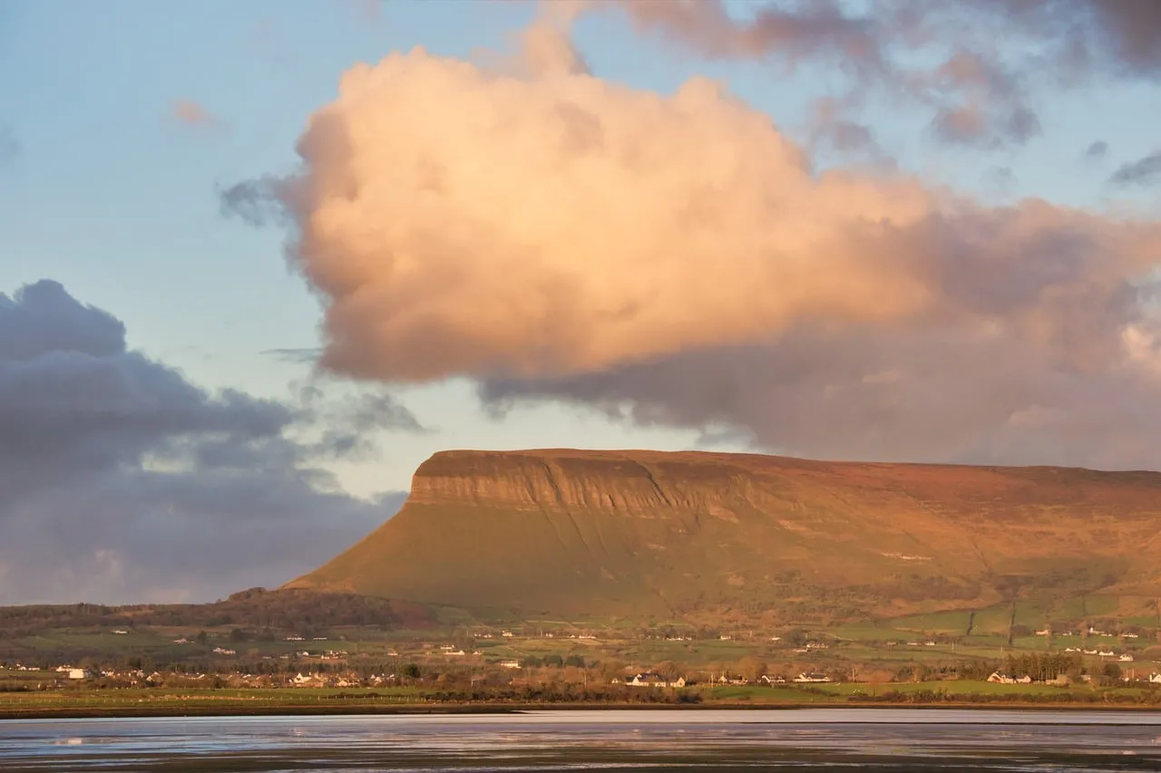
Ben Bulben Mountain, a striking flat-topped peak in County Sligo, dominates the northwestern landscape as part of the Dartry Mountain Range. Known locally as 'Sligo's Table Mountain' for its distinctive plateau shape, it rises 526 meters above sea level, its jagged limestone cliffs contrasting with the rolling countryside below. Formed by glacial movements during the Ice Age, the mountain's bedrock of limestone and shale contains fossils of ancient sea creatures, a relic of its submerged origins 320 million years ago. Its Irish name, Binn Ghulbain, translates to "Gulban's Peak," referencing a Gaelic chieftain, while its jaw-like profile-visible from miles around-has anchored it in local lore for millennia.
Cultural and historical layers deepen Ben Bulben's allure. The mountain is central to Irish mythology, said to shelter the lovers Diarmuid and Gráinne in a high-altitude cave, and believed to house a "fairy door" on its north face-a crack in the rock thought to signal fair weather when "open." For poet W.B. Yeats, Ben Bulben was both muse and final resting place; he lies buried in Drumcliffe Cemetery at its base, as he requested in his poem Under Ben Bulben, which calls for a burial "under bare Ben Bulben's head." The mountain's rugged beauty and associations with storytelling have cemented its place as a symbol of Sligo's "Yeats Country."
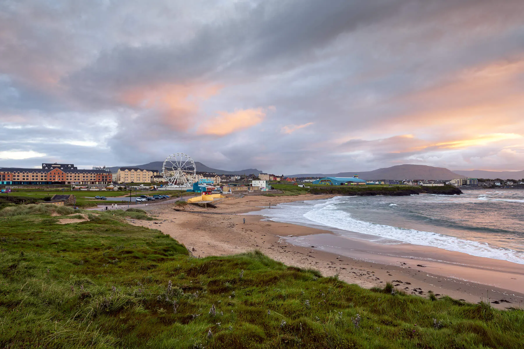
Visitors are drawn to Ben Bulben's dual identity as a natural wonder and adventure destination. The south face offers a gradual ascent to the windswept summit, where views stretch across Sligo Bay, the Wild Atlantic Way coastline, and, on clear days, the dramatic cliffs of Donegal's Slieve League. Hikers may traverse the Ben Bulben Loop Trail, passing glacial gullies and the whispering streams that carve its slopes, or follow the Forest Walk through ancient woodlands to the waterfall at Glencar. However, the north face remains perilous, with sheer drops and unpredictable winds demanding experienced climbers and sturdy gear.
The mountain's ecological richness adds to its intrigue. Arctic-alpine plants like the Fringed Sandwort-a survivor from the last Ice Age-and the rare Tea Leaf Willow cling to its crevices, surviving in microclimates untouched by millennia of change. These species, along with red foxes, choughs, and wild hares, thrive in an ecosystem shaped by both glacial forces and human mythmaking.
Best visited between May and September, when paths are dry and daylight generous, Ben Bulben reveals different facets year-round. Winter cloaks its peaks in snow, transforming the landscape into a stark, elemental tableau, while autumn paints the lower slopes in hues of gold. Whether approached for its geological grandeur, literary legacy, or the thrill of its trails, Ben Bulben stands as a monument to Ireland's layered past and enduring wildness-a place where ancient stories and modern exploration converge under its weathered gaze.
Getting There
Best Way to Get to Ben Bulben Mountain, County Sligo
Transportation Options:
-
By Car (Recommended): - From Dublin: Drive 200 km (124 miles) northwest on the N4/N15, taking approximately 2.5 hours. - From Sligo:
- Route 1: Take the N15 towards Donegal for ~10 km, then turn right at a signposted turn uphill (near Mullaghmore). Follow the narrow road to the Main Car Park (526m elevation) directly beneath the mountain.
- Route 2: Head north along the coastal road. Turn right onto a small road towards Ballintrilick near the mountain. Look for a water treatment station near the turn-off. Park at Luke's Bridge (5 km north of Drumcliffe) and follow the stream to begin the climb.
- Parking Options:
- Main Car Park: Located at the base of the mountain via the N15 turn.
- Gortarowey Forest Car Park: For the Benbulben Forest Walk (6 km loop).
- Luke's Bridge: Park near the stone bridge for trail access.
-
Public Transport: - Buses or trains to Sligo (e.g., from Dublin), but no direct public transport to Ben Bulben. - Walking from Sligo is possible but long and strenuous (~10+ km).
Key Directions & Tips:
- No Signs for Ben Bulben: Use landmarks like the water treatment station or signposted turn towards Mullaghmore/Ballintrilick.
- Trailhead Access:
- South Side: Easiest climb, with a paved path near Glencar Waterfall (just over the County Leitrim border).
- Gortarowey Loop Walk: 5.5 km trail accessible from the Main Car Park.
- Benbulben Forest Walk: 6 km loop from Gortarowey Car Park (easy, buggy-friendly).
- Private Land Note: The western edge of the ridge is privately owned farmland-stick to marked trails.
Nearby Landmarks & Points of Interest:
- Drumcliffe Cemetery: Home to WB Yeats' grave (4 km from Ben Bulben).
- Glencar Waterfall: A short distance into County Leitrim, near the southern trailhead.
Trail Difficulty & Accessibility:
- Main Summit Trail: Moderate to strenuous (check weather and trail conditions).
- Gortarowey & Forest Trails: Easy to moderate, with well-maintained paths.
Final Tip: Carry a map/GPS, as signage is minimal. Consider visiting during daylight hours for safety.
Nearby Attractions

Bundoran Golf Course
Perched on rugged cliffs overlooking Donegal Bay, Bundoran Golf Club isn't just old – it's one of Ireland's founding golf courses, dating back to 1894. Right on the Wild Atlantic Way, this classic lin...
Distance: 13.3 km
Bundoran Beach (Main Beach)
Bundoran Main Beach, right at the southern tip of County Donegal, is famous throughout Ireland, known especially as the country's 'Surf Capital.' Having hosted European Surfing Championships, its repu...
Distance: 13.5 km
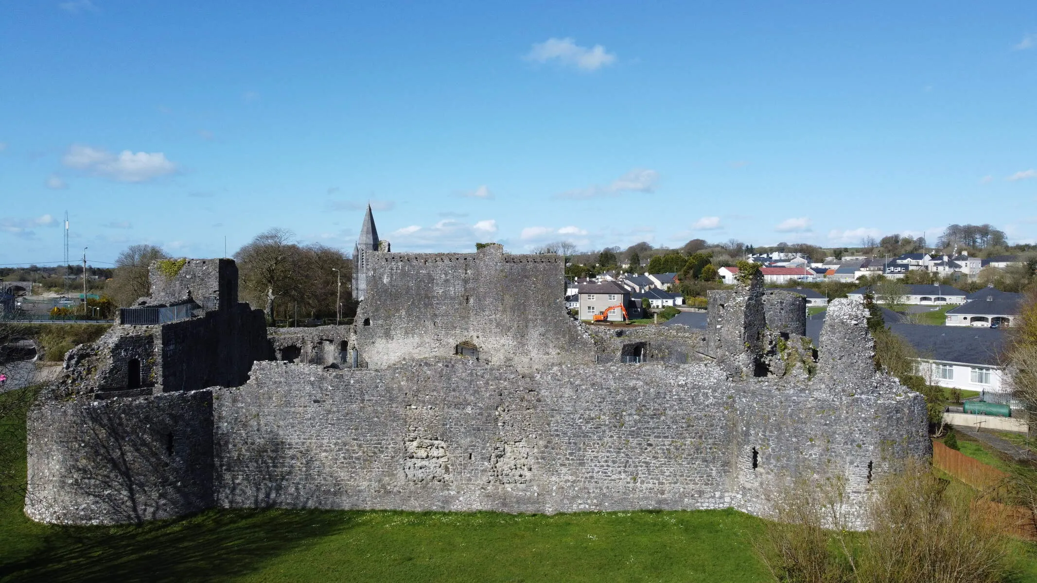
Ballymote Castle
On the edge of Ballymote town in County Sligo, the imposing ruins of Ballymote Castle tell a story of Norman ambition in 14th-century Ireland. Built around 1300 by the powerful Norman noble Richard de...
Distance: 31.8 km