
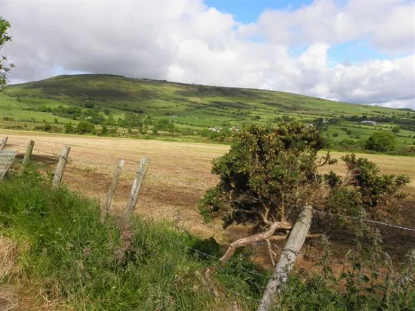
Bessy Bell is the rounded 420 m hill that rises behind Newtownstewart, and its Irish name, Sliabh Troim, ‘mountain of elder’, is far older than the Scottish one painted onto it by 17th-century settlers. On a clear day the view from Donald Gorm’s cairn takes in the Derg Valley below, the Sperrin range and the hills of Donegal on the horizon.
If you only get one decision right here, make it the weather. The summit cairn is the whole point of the walk, and there is no shelter at all when the cloud comes down. Wind farms and a phone mast share the upper slopes, and the turbines can be loud.
The walk
Pick the right route
OutmoreNI’s Bessy Bell East route starts by the Mellon Country Hotel on the A5. It is an out-and-back over farmland, forestry tracks and open moorland. Visit Derry also describes a longer linear outing using the Ulster Way. Use the map for your chosen route and check current trailhead and parking arrangements.
The surface keeps changing: tarmac road at the bottom, then country lanes, then gravel tracks laid for the wind farm, and finally rough grass and heather across the open top. About halfway up you pass a holy well, once used by local people for ritual cleansing and still visible beside the path. The summit carries Donald Gorm’s cairn, a stone pile named for a legendary chieftain, and the point where the walk turns back. Leave time at the top for the view and at the well on the way.
Part of the walk crosses a working forest. Obey diversions and closures, stay on signed paths, and bring a map and layers for the exposed ground.
The name and the ballad
The name came over with Scottish settlers and points back to a hill in Perthshire tied to the ballad of Bessy Bell and Mary Gray, two young women who, in the telling, fled the 1645 plague to a bower in the woods and died there after a suitor carried the sickness to them. The Tyrone hills, Bessy Bell and her smaller neighbour Mary Gray, took the borrowed names, and the story is still told locally as you look across at the pair.
Practical information
The hill is a listed birdwatching site, with meadow-pipits and skylarks on the open slopes, most vocal early in the day. The open top gives wide views in every direction, so it rewards a clear morning. Stay on the marked paths, carry your litter out, and leave the holy well as you found it. The walk is free, but it runs through working forestry and may be diverted or closed, so check before travelling.
Nearby
- Ulster American Folk Park – a living-history museum on the A5 telling the Ulster emigration story, a separate visit nearby.
- Harry Avery’s Castle – the ruins of a 14th-century O’Neill stronghold above Newtownstewart.
Check the forecast and the forestry notices before you set out: the bare summit gives you nowhere to wait out a squall, and the working forest the path crosses is occasionally closed.