
Overview
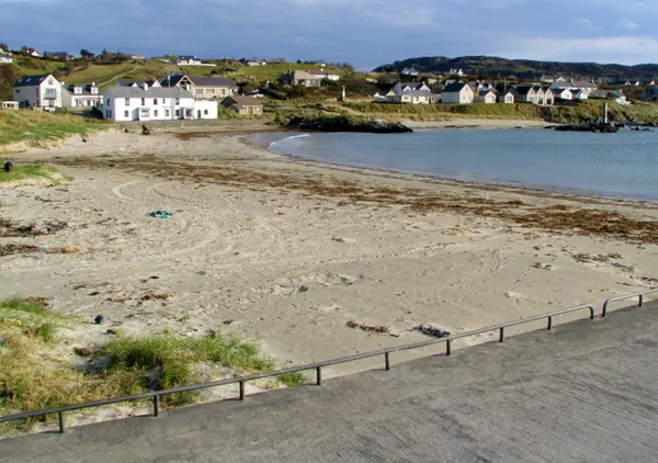
Portnablagh is a small village on Sheephaven Bay with a little curve of sand tucked in behind a working pier. It is one of several beaches strung along this stretch of the Dunfanaghy coast, and it sits in the lee of the pier rather than facing the open Atlantic as nearby Killahoey and Marble Hill do. The Irish name, Port na Bláiche, is read either as ‘Port of the Flowers’ or ‘Harbour of the Buttermilk’ – the buttermilk pointing to the froth the sea whips up here when the weather turns.
The village is a short drive from Dunfanaghy and curls around its little harbour, which stays busy with local boats. The land behind rises into open headland with wide views out to Horn Head and across the bay.
The beach and harbour
The pier shelters the beach on its northern side. The slipway is used by kayakers, sailors and the odd pleasure craft in summer, and the pier itself is a spot for a bit of sea angling. Keep the slipway and working areas clear, and keep children away from the slipway and harbour traffic.
The EPA lists Portnablagh as a monitored bathing water. Check its current warnings before you go in and follow the signs and flags at the shore. Do not count on lifeguard cover, toilets or other facilities being in place on the day. If you plan to swim, choose a time and place with lifeguard cover, and check tides and conditions first, because the open Atlantic is close by.
Faugher House
At the south-eastern edge of the village, near Ards Forest Park, stand the ruins of Faugher House, known locally as O’Boyle’s Castle or Wray’s Castle. It’s a fortified house from the Plantation of Ulster, built around 1611 for Toirdhealbhach Ruadh Ó Baoighill. The bawn wall survives from that time; the main house may have gone up later for the Wray family, and the whole place was abandoned by the mid-1700s. It’s privately owned and closed to the public, but the ruin can be seen from the public road – a stark marker of the century that reshaped who owned this land.
Wildlife
Sheephaven Bay is a Special Protection Area for seabirds, so the headlands and shoreline are good for gulls and other seabirds. At low tide the rocks hold rock-pools worth a poke about with children, so long as you take care on the weed. For more woodland and beach walking, Ards Forest Park lies just south of the village.
Practical information
Portnablagh is reached by car on the N56, which links Letterkenny to the north-west coast, scenic most of the way. Park only in signed public parking and leave harbour operations clear. Mobile signal can be patchy in the village and out on the headlands, so download any maps you’ll need before you set off.
For anything larger – supermarket, pubs, restaurants, accommodation, tourist information – Dunfanaghy is only a few kilometres away and is the gateway to the surrounding Gaeltacht.
Getting there
- By car: From Letterkenny, follow the N56 west towards Dunfanaghy, then continue to Portnablagh.
- By public transport: Bus Éireann serves Letterkenny and Dunfanaghy, but check current timetables and stops before you travel, as availability varies by season.
- By air: The nearest airports are Donegal Airport at Carrickfinn and Derry-Londonderry Airport.
Nearby
North of the village, the headland of Horn Head gives panoramic views over Sheephaven Bay and the open Atlantic. To the south, Coillte’s Ards Forest Park has woodland and beach trails; follow the signed trails and check the park’s opening hours before travelling. Breaghy Head and Marble Hill Strand add more coast walking close by, and Doe Castle sits across the bay. Pair Portnablagh’s beach with an afternoon in Ards Forest Park and you have a full, low-key day on this corner of the Donegal coast.