Walks & Trails in County Antrim

The nine glens and the north coast account for most of this list. Glenariff is the glen to prioritise if you only walk one, for its forest waterfalls; the wider Antrim Coast and Glens AONB runs from Larne to Ballycastle, taking in sea cliffs, waterfall valleys and Rathlin’s seabird colonies. The Causeway Coast Way covers around 52 km of that shoreline, and the North Antrim Cliff Path is its best-known stretch: roughly 8 km over National Trust farmland from Dunseverick Castle, finishing down the 162 Shepherd’s Steps onto the Causeway itself.

Further west, Portrush to Bushmills is 10.6 km one way on paths, sand and exposed rock, past East Strand, the White Rocks and the ruins of Dunluce Castle. For something shorter, Glenoe Waterfall, about 8 km south of Larne, is a circuit of stone steps down a wooded gorge to a nine-metre fall, free and open dawn to dusk. Murlough Bay needs a car; the road in is single-track and there is no bus.

Not all of it is coastal. The Belfast Hills, Cave Hill, Divis, Black Mountain and Slievenacloy, give free open walking on the city’s doorstep, with McArt’s Fort the usual target. Inland, the Broad Water towpath at Aghalee is flat and fully accessible for three miles from Moira station. The higher ground changes with the season: Divis and the Garron Plateau are blanket bog, and wet underfoot for much of the year.

30 of 31 shown — tap a pin for the place.

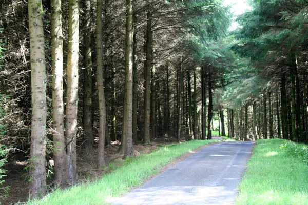
In Ballypatrick Forest - geograph.org.uk - 515697
In Ballypatrick Forest - geograph.org.uk - 515697 Cormac Duffin / Wikimedia Commons / CC BY-SA 2.0

Ballypatrick Forest – walks and a cairn

Ballycastle, antrim

Just south of Ballycastle, Ballypatrick Forest mixes a rare double-chambered Neolithic cairn, mature woodland and the stone-arched Irish Ford. The scenic forest drive is now closed to cars after harvesting, but the waymarked Wildlife Trail and the upland views over Rathlin Island remain.

🌳 Outdoor 🅿️ Free Parking 🐕 Dogs Welcome
Belfast Castle, Belfast, Co. Antrim (21183016023)
Belfast Castle, Belfast, Co. Antrim (21183016023) National Library of Ireland on The Commons / Wikimedia Commons / Public domain

Belfast Hills – Cave Hill and Divis walks

Belfast, antrim

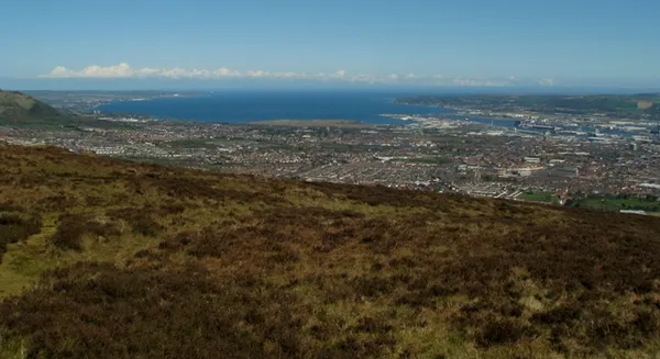
The ring of hills above Belfast – Cave Hill, Divis, Black Mountain and Slievenacloy – give free, open walking with views over the Lough to Scotland and the Isle of Man. Trails run from a paved castle loop to the boggy Divis ridge; McArt's Fort, the rocky outcrop known as Napoleon's Nose, is the one to head for.

🌳 Outdoor 🐕 Dogs Welcome
The Braid, Ballymena (2)
The Braid, Ballymena (2) Albert Bridge / Geograph / CC BY-SA 2.0

Braid River – Ballymena's riverside walk

Mid and East Antrim, antrim

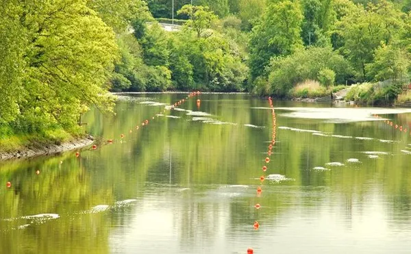
The Braid is a small, fast spate river that runs about 15 miles down from the Antrim Hills through Broughshane and Ballymena to join the River Main. Its easy, paved riverside path makes a pleasant local stroll or dog walk rather than a day out, and the Braid Angling Club runs a 7-mile stretch for wild brown trout, salmon and the Lough Neagh Dollaghan.

🌳 Outdoor 🐕 Dogs Welcome
Looking North East up Dungonnell - geograph.org.uk - 800092
Looking North East up Dungonnell - geograph.org.uk - 800092 Philip / Wikimedia Commons / CC BY-SA 2.0

Dungonnell Way

Dungonnell Road, antrim

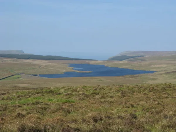
The Dungonnell Way is a way-marked 9.5-mile loop above Cargan in the Antrim glens, half of it on quiet lanes and half on bog and forest track. It follows the line of a vanished narrow-gauge railway that once hauled iron ore to the coast, and skirts the Garron Plateau, the largest intact blanket bog in Northern Ireland.

🌳 Outdoor 🅿️ Free Parking 🐕 Dogs Welcome
Glenoe Waterfall, Gleno, Co Antrim
Glenoe Waterfall, Gleno, Co Antrim Courtesy of Mid and East Antrim Council @Sync Imaging

Glenoe Waterfall – a short glen walk to a nine-metre fall

Larne, antrim

Glenoe Waterfall drops about nine metres through a deep wooded gorge behind the whitewashed hamlet of Gleno, roughly 8km south of Larne. A short circuit of stone steps runs down both sides of the glen to a footbridge and a rocky platform close enough to feel the spray. It is owned by the National Trust, free to visit, and open dawn to dusk all year.

🌳 Outdoor 🅿️ Free Parking
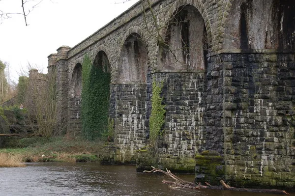
Former railway viaduct at Randalstown (1)
Former railway viaduct at Randalstown (1) Albert Bridge / Geograph / CC BY-SA 2.0

Lanyon Viaduct – Randalstown's High Line

Randalstown, antrim

Charles Lanyon's eight-arch viaduct carried the Belfast & Ballymena Railway over the River Maine until the line closed. Since 2022 its deck has been a community garden called Elevation, modelled on New York's High Line, and since 2024 it's lit warm-white after dark. Free, open all hours, entered from Station Road or New Street.

🌳 Outdoor 🅿️ Free Parking 🐕 Dogs Welcome
View of Murlough Bay, Co. Antrim
View of Murlough Bay, Co. Antrim Courtesy of Fairhead Glamping Pods

Murlough Bay – Antrim's remote inlet

antrim

Murlough Bay is a remote inlet between Fair Head and Torr Head, reached by a single-track road with no bus and views across to Rathlin Island and the Mull of Kintyre. Roger Casement asked to be buried here – a stone plinth marks the spot – and Game of Thrones filmed it as Slavers Bay. A 4.4 km loop from Murlough Road drops to the beach past Knockbrack Viewpoint.

🌳 Outdoor 🐕 Dogs Welcome
Portrush to Bushmills – Causeway Coast walk
© Tourism Ireland © Chris Hill Photographic @chrishillphotographer

Portrush to Bushmills – Causeway Coast walk

Portrush, antrim

The Portrush-to-Bushmills walk runs 10.6 km one way along the Causeway Coast, from Portrush Harbour past East Strand, the White Rocks cliffs and the ruins of Dunluce Castle. It's a moderate walk on mixed ground – paths, sand and some exposed rock and steps – ending at Bushmills Station, a short walk from the Old Bushmills Distillery.

🌳 Outdoor 🅿️ Free Parking 🐕 Dogs Welcome
Strolling the Martime Mile, Titanic Quarter, Belfast, Co. Antrim
Strolling the Martime Mile, Titanic Quarter, Belfast, Co. Antrim Courtesy of Tourism Northern Ireland

Sailortown – Belfast’s dockland quarter

Belfast, antrim

Sailortown was Belfast’s first waterfront village, home to over 5,000 dockers, seamen and mill workers, and the place where James Larkin launched the 1907 dock strike that founded the ITGWU. Urban redevelopment and the M2 motorway erased most of it in the late 1960s. Two churches, three houses and one pub survive, strung along the Maritime Mile waterfront trail.

🌳 Outdoor
Stormont Parliament Buildings, Stormont, Belfast, Co Antrim
Stormont Parliament Buildings, Stormont, Belfast, Co Antrim Courtesy of Rob Durston for Tourism Northern Ireland, ©TourismNorthernIreland

Stormont – Parliament Buildings tour

Belfast, antrim

Parliament Buildings, opened in 1932, is the neo-classical home of the Northern Ireland Assembly at the head of the Stormont Estate avenue. It is 365 feet long – a foot for each day of the year – with six columns for the six counties. Free 45-minute guided tours run Wednesday to Friday, and the public gallery opens when the Assembly sits.

🌳 Outdoor 🅿️ Free Parking

Questions people ask

Which Antrim walk should I do if I only have a couple of hours?
Glenoe Waterfall near Larne is the shortest thing here: a circuit of stone steps down both sides of a wooded gorge to a nine-metre fall, free and open dawn to dusk. Murlough Bay's loop is 4.4 km.
Where on the county do these walks cluster?
Most sit on the coast between Larne and Ballycastle and around the Causeway, taking in the glens, the North Antrim Cliff Path and the Portrush to Bushmills route. Belfast, Randalstown and Aghalee are the main inland exceptions.
Are any of them doable without a car?
The Belfast Hills sit right above the city, and the Broad Water towpath at Aghalee starts from Moira railway station. Portrush to Bushmills ends at Bushmills Station. Murlough Bay is the awkward one, reached by a single-track road with no bus.
Is there anything flat and pushchair or wheelchair friendly?
The Broad Water towpath at Aghalee is a flat, fully accessible three miles from Moira station, and good for winter birdwatching. Randalstown's eight-arch railway viaduct was converted to a level walkway and cycle path after the line closed.
Which of these are hardest going underfoot?
The Garron Plateau and the Divis ridge are blanket bog and stay wet for much of the year. Portrush to Bushmills is moderate but mixes paths, sand, exposed rock and steps, so it is slower than the distance suggests.

← All things to do in County Antrim

Book tours & tickets

Powered by GetYourGuide

We may earn a commission if you book through this link, at no extra cost to you.

Book tours, skip-the-line tickets and day trips with GetYourGuide. Free cancellation on most experiences.

See tours & tickets in County Antrim →
Advertisement