Walks & Trails in County Down

Two very different sorts of walking sit on this list. The Mournes account for much of it: Tollymore Forest Park at Bryansford, where the Shimna River runs under sixteen stone bridges through 630 hectares of woodland; Bloody Bridge on the coast road out of Newcastle, where the old smugglers’ track climbs inland along the Brandy Pad; Ben Crom, reached on foot from Silent Valley now that driving to the dam is no longer allowed; and above all of them the Mourne Wall, close to twenty miles of dry-stone granite over fifteen summits.

The rest is gentler and further north. Broad Water at Moira is three flat tarmac miles of abandoned canal towpath, and the Comber Greenway runs seven traffic-free miles from east Belfast out to Comber past CS Lewis Square. Both are level and neither needs boots. Helen’s Tower sits at the end of a 4.2km woodland walk on the Clandeboye Estate near Bangor, and Scrabo Tower crowns its hill above Newtownards, the country park open daily even when the tower itself is shut.

East of that lies Lecale, the low peninsula between Strangford Lough and Dundrum Bay, where the 76km Lecale Way strings together Norman tower houses, Saul and Downpatrick. The high Mourne ground is exposed and needs settled weather and proper navigation; the towpaths and greenways will take a wet afternoon without complaint.

Where to start

  1. Tollymore Forest Park – Mourne forest walks Bryansford

    Northern Ireland's first state forest park, with an accessible arboretum, riverside paths past the Hermitage and Gothic follies under the Mourne foothills.

  2. Ardglass – Tower houses and a links course Ardglass

    A working fishing harbour ringed by four medieval tower houses, more than any town in Ireland, with a links course running along the Irish Sea.

  3. Bloody Bridge – Mourne coast and Brandy Pad Newcastle

    The stone crossing where smugglers once carried contraband inland, and still the usual start for the Brandy Pad pony track into the high Mournes.

22 of 22 shown — tap a pin for the place.

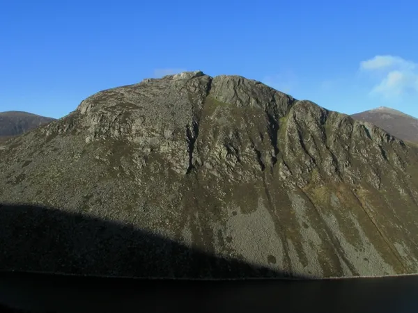
Ben Crom - geograph.org.uk - 1140038
Ben Crom - geograph.org.uk - 1140038 Ross / Wikimedia Commons / CC BY-SA 2.0

Ben Crom – dam walk in the high Mournes

Newcastle, down

Ben Crom is a 526 m granite peak deep in the Mourne Mountains, standing over a mass-concrete dam that holds 1.7 billion litres of water. Most visitors never climb it; the draw is the walk in from Silent Valley along the reservoir road, with the crags and water opening up ahead. Driving to the dam is no longer allowed, so come ready for a proper walk.

🌳 Outdoor 🐕 Dogs Welcome
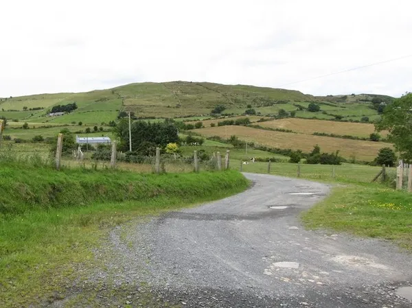
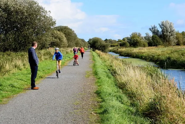
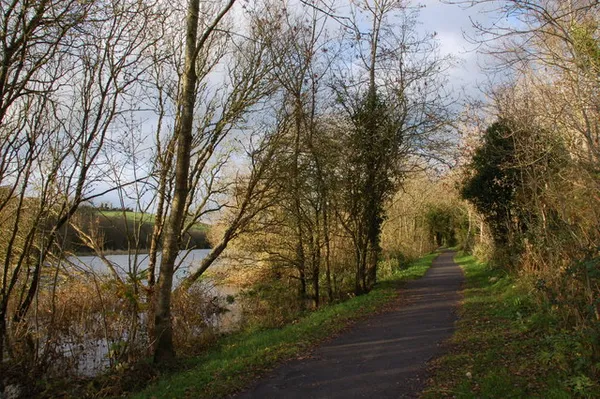
Broad Water Cycle Path, Magheramesk
Broad Water Cycle Path, Magheramesk Kenneth Allen / Geograph / CC BY-SA 2.0

Broad Water – Moira's old canal towpath

Moira, down

Broad Water is a flat, tarmac 3-mile towpath along the abandoned Lagan Canal, running from Moira railway station to Aghalee through Soldierstown. The canal was given up in 1954 and the banks have re-wilded; the lagoon draws breeding and wintering wildfowl, and an 1833 railway bridge still shows the tow-rope notches worn into its iron rails. It is one of the most accessible heritage walks in County Down.

🌳 Outdoor 🅿️ Free Parking
The Lecale Peninsula from Slieve Commedagh, County Down
The Lecale Peninsula from Slieve Commedagh, County Down Hogweard / Wikimedia Commons / Public domain

Lecale – Ireland’s three patron saints

East coast of County Down, down

A low, sea-ringed peninsula in east County Down, between Strangford Lough and Dundrum Bay, and by tradition the burial place of Ireland’s three patron saints at Downpatrick. Norman tower houses ring the coast, the 76 km Lecale Way links them, and it all sits inside the Mourne Gullion Strangford UNESCO Geopark.

🌳 Outdoor
Mourne Wall on Seefin, Co. Down
Mourne Wall on Seefin, Co. Down Courtesy of Kribben Cottages, @PaulaHaugh

Mourne Wall – A Granite Sentinel Across the Mournes

Mourne Mountains, down

Built over 18 years by stonemasons working March to October, the Mourne Wall runs close to 20 miles over fifteen peaks above Silent Valley Reservoir. This dry-stone granite barrier was raised to protect Belfast's water supply, and it now doubles as a navigation aid for walkers on some of the range's most exposed ground.

🌳 Outdoor 🐕 Dogs Welcome
Slieve Patrick Saul 5390
Slieve Patrick Saul 5390 www.bbphotographic.co.uk. Copyright Bernie Brown bbphotographic. All rights reserved. Mobile - 07831164371

Saul – where Irish Christianity began

Saul, down

Saul is where, by tradition, Saint Patrick was given a barn for his first church in Ireland in 432. The village holds a 1930s church built in early Irish style, complete with a replica round tower, and a steep climb up Slieve Patrick to a giant bronze statue of the saint. Pilgrim paths run from here to Down Cathedral, where Patrick is said to be buried.

🌳 Outdoor 🅿️ Free Parking
Scrabo Tower, Co Down (1)
Scrabo Tower, Co Down (1) Hunter Bros for Ards and North Down Borough Council

Scrabo Tower

Scrabo Hill, down

Scrabo Tower is a Victorian folly built in 1857 as a memorial to the 3rd Marquess of Londonderry, standing on a 540-foot hill above Newtownards. When it's open, 122 steps lead to a parapet with views over Strangford Lough, the Mourne Mountains and, on a clear day, the coast of Scotland. Most of the time the tower is shut, but the surrounding country park stays open daily.

🌳 Outdoor 🐕 Dogs Welcome
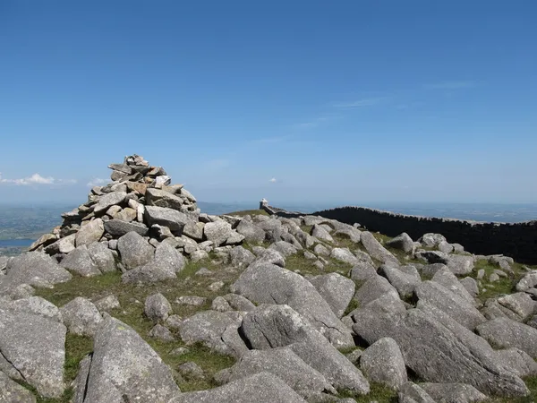
The cairn on the summit of Slieve Meelmore - geograph.org.uk - 4089345
The cairn on the summit of Slieve Meelmore - geograph.org.uk - 4089345 Eric Jones / Wikimedia Commons / CC BY-SA 2.0

Slieve Meelmore – Mourne Wall walk

Slieve Meelmore, down

For twelve years Slieve Meelmore was counted as one of the Mourne Sevens, until a walker in 2004 worked out it falls just short of 700 m. It is the seventh-highest of the Mournes at 680 m, its summit crossed by the Mourne Wall and marked by a small stone shelter, with views on a clear day to the Sperrins, Lough Neagh and Strangford Lough.

🌳 Outdoor 🅿️ Free Parking 🐕 Dogs Welcome
Slievenaboley Mountain from the Moat Pad
Slievenaboley Mountain from the Moat Pad Eric Jones / Geograph / CC BY-SA 2.0

Slievenaboley – a big view, no path

Slievenaboley, down

Slievenaboley is a modest 324 m rise in the Dromara Hills with no waymarked route to the top – you follow farm tracks and climb a series of wire fences to reach a rocky plateau. The reward is a wide, quiet panorama of the Mournes, Slieve Croob and the Belfast Hills, and the near-certainty of having it to yourself.

🌳 Outdoor 🅿️ Free Parking 🐕 Dogs Welcome

Questions people ask

Which County Down walks are flat and suitable for buggies or wheelchairs?
Broad Water at Moira is a flat tarmac towpath of about three miles from the railway station to Aghalee, described as one of the most accessible heritage walks in the county. The Comber Greenway is level and traffic-free for seven miles, and Tollymore has an accessible arboretum.
Where do most of these walks cluster?
The Mourne group sits in the south around Newcastle: Tollymore at Bryansford, Bloody Bridge on the coast road, Ben Crom above Silent Valley and the Mourne Wall across the summits. A second cluster lies north near Belfast and Strangford Lough, with Comber Greenway, Scrabo and Helen's Tower.
Can you still drive up to Ben Crom dam?
No. Driving to the dam is no longer permitted, so the reservoir road in from Silent Valley is walked in both directions. Most people treat it as the outing in itself rather than climbing the 526m peak above it.
What is worth doing in poor weather?
Keep off the Mourne Wall and the high ground, which is exposed and needs navigation. The lower options hold up better: the Comber Greenway, the Moira towpath, the woodland paths at Tollymore and the Clandeboye walk to Helen's Tower, or a signposted town walk at Dromore.
Is Scrabo Tower open to climb?
Not often. The tower is shut most of the time, though when it does open, 122 steps lead to a parapet looking over Strangford Lough, the Mournes and, on a clear day, Scotland. The surrounding country park is open daily regardless.

← All things to do in County Down

Book tours & tickets

Powered by GetYourGuide

We may earn a commission if you book through this link, at no extra cost to you.

Book tours, skip-the-line tickets and day trips with GetYourGuide. Free cancellation on most experiences.

See tours & tickets in County Down →
Advertisement