Lakes, Rivers & Waterfalls in County Dublin

Water in this county comes in three shapes. In the north the tide is penned back behind railway embankments: Broadmeadow Estuary, between Swords and Malahide, became a sheltered lagoon after the 1840s viaduct pinched off the river mouth, and the estuary at Baldoyle fills each winter with light-bellied Brent geese. There are no hides or boardwalks at Baldoyle, so you watch from the coast road and the shore.

South and west of the city the rivers carry it. At Firhouse, 10km from the centre, the 13th-century Balrothery Weir marks where Dodder water was sent into the Poddle to supply medieval Dublin, and the greenway now runs from the weir under the M50. The Poddle spends almost all of its 11.6 km underground, surfacing at Tymon Park, Kimmage and Mount Jerome. The Camac, once culverted and polluted, is under a volunteer clean-up, though a 2026 crayfish plague outbreak means anyone entering it must Check, Clean and Dry.

Two entries sit out on the Grand Canal near the Kildare border, well outside the city: Gollierstown Bridge, an arch of about 1780 west of Lucan carrying only a gated farm track, with tow-rope grooves worn into its north pier, and Hazelhatch, where a 5km surfaced greenway from the 12th Lock opened in 2026. Grand Canal Dock and Malahide Marina are the easiest of the thirteen, both free to wander and a short walk from the DART.

13 of 13 shown — tap a pin for the place.

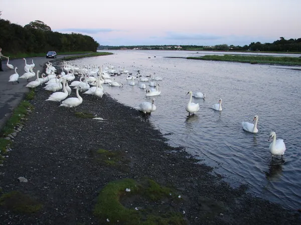
Baldoyle – Brent geese on the estuary
William Sadler / Wikimedia Commons / Public domain

Baldoyle – Brent geese on the estuary

North-east Dublin, dublin

Baldoyle is a residential Dublin suburb wrapped around a protected estuary that matters most in winter, when thousands of light-bellied Brent geese arrive from Arctic Canada. The name comes from the dubh-ghaill, the 'dark foreigners', the Danish Vikings who beached their longboats here. There are no boardwalks or hides: you watch the birds from the coast road and the shore, then find a village pub.

🌳 Outdoor
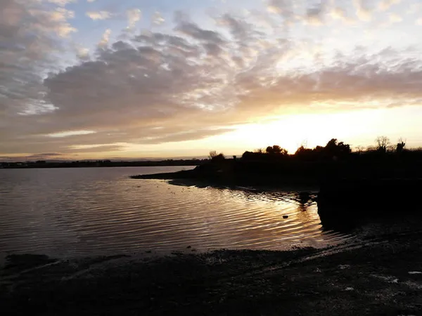
Winter sunset on the Broadmeadows estuary
Winter sunset on the Broadmeadows estuary Gerry Doyle / Geograph / CC BY-SA 2.0

Broad Meadow River – the Malahide estuary

Meath, meath

The Broad Meadow River rises near Dunshaughlin in Meath and runs about 25 km to the sea at Malahide, where an 1800s railway viaduct pens it into a shallow, half-tidal lagoon. That estuary is a protected bird site, best in winter when wildfowl and waders feed on the exposed mudflats. A 6 km greenway along its edge, linking Malahide and Newbridge demesnes, is due to open in 2027.

🌳 Outdoor
Evening Meal - geograph.org.uk - 526882
Evening Meal - geograph.org.uk - 526882 Ian Paterson / Wikimedia Commons / CC BY-SA 2.0

Broadmeadow Estuary – Swords birdwatching

Swords, dublin

Broadmeadow is a man-made lagoon: the 1840s railway viaduct pinched off the tide and turned the river mouth into a sheltered basin between Swords and Malahide. At low tide the mudflats pull in brent geese, waders and wildfowl, so autumn and winter mornings are the times to come with binoculars. A greenway and a 280-metre bridge across the viaduct are still under construction, due to open around 2027.

🌳 Outdoor 🅿️ Free Parking 🐕 Dogs Welcome
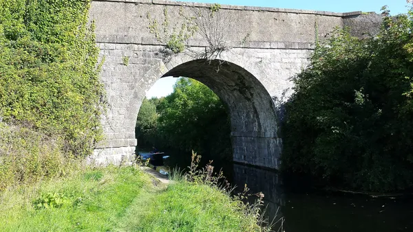
County Dublin - Gollierstown Bridge - 20150926154524
County Dublin - Gollierstown Bridge - 20150926154524 Ashnazgul / Wikimedia Commons / CC BY-SA 4.0

Gollierstown Bridge – 1780s canal arch

Gollierstown, dublin

Gollierstown Bridge is a single-arch stone bridge of about 1780 on a quiet, remote stretch of the Grand Canal west of Lucan. Listed by the National Inventory of Architectural Heritage, its detail worth seeking out is the set of deep grooves cut into the north pier by the tow-ropes of canal horses. It now carries only a gated farm track.

🌳 Outdoor
Dodder River Valley Linear Park, South Dublin
Dodder River Valley Linear Park, South Dublin Courtesy of Gail Connaughton, Fáilte Ireland/Tourism Ireland

River Dodder – Dublin's wild city river

Dublin, dublin

Dublin's largest Liffey tributary runs 26 km from the slopes of Kippure to the city centre, threading south-side suburbs and keeping a rare ribbon of semi-wild nature. Follow the Dodder for accessible riverside trails, otters and kingfishers in restored habitats, and trout and sea trout fishing in the lower stretches.

🌳 Outdoor 🅿️ Free Parking 🐕 Dogs Welcome
Poddle River course from Tymon source to Mount Argus
Poddle River course from Tymon source to Mount Argus Myself. Original map by Ordnance Survey. / Wikimedia Commons / Public domain

River Poddle – Dublin's buried river

Dublin, dublin

The River Poddle runs about 11.6 km, almost all of it underground, from Tallaght to the Liffey at Wellington Quay, where the tidal pool it once formed, the dubh linn, gave Dublin its name. It fed the city's first water supply, powered its mills and filled Dublin Castle's moat, and survives today in a few open stretches at Tymon Park, Kimmage and Mount Jerome.

🌳 Outdoor

Questions people ask

Where in Dublin can I see Brent geese and waders in winter?
Baldoyle and Broadmeadow are the two estuaries on this list. Both draw brent geese, waders and wildfowl onto exposed mudflats, so autumn and winter mornings around low tide are the times to come. Bring binoculars; Baldoyle has no hides, and you watch from the coast road.
Which of these can I reach easily from the city centre?
Grand Canal Dock sits in the docklands itself, free and open around the clock, and Malahide Marina is a five-minute walk from the DART with the promenade running into the village. The Dodder, Tolka and Poddle all thread through suburbs on foot.
Are any of the riverside and canal walks surfaced or wheelchair accessible?
The 5km greenway from the 12th Lock to Hazelhatch, opened in 2026, is fully surfaced and wheelchair-accessible. The Tolka has traffic-free paths through Tolka Valley Park and past the Botanic Gardens, and the Dodder has accessible riverside trails on its lower stretches.
Which ones need a car?
Gollierstown Bridge and Hazelhatch are the outliers, both on quiet stretches of the Grand Canal west of Lucan on the Kildare border. Gollierstown now carries only a gated farm track, and Hazelhatch has one canal-side pub, no shop and no square.
Is there anything to know before going into the water?
A crayfish plague outbreak on the Camac in 2026 means anyone using the river should Check, Clean and Dry their gear before and after. On the lower Dodder there is trout and sea trout fishing, and otters and kingfishers in the restored habitats.

← All things to do in County Dublin

Book tours & tickets

Powered by GetYourGuide

We may earn a commission if you book through this link, at no extra cost to you.

Book tours, skip-the-line tickets and day trips with GetYourGuide. Free cancellation on most experiences.

See tours & tickets in County Dublin →
Advertisement