
Great Western Greenway
mayo
🌳 Outdoor
The Great Western Greenway sets the tone here: 42 km of converted 1890s railway from Westport to Achill Sound, flat, traffic-free and running along the edge of Clew Bay, with Newport sitting midway and the last window Harry Clarke designed in its church. Much of the rest of the list sits either side of that line. Drummin lies at the foot of Croagh Patrick in the Tóchar Valley, close to Brackloon Wood; Ben Gorm rises above Killary Harbour on the Galway border, a steep unmarked ridge that needs navigation skills and a dry spell.
The second cluster is Erris, in the far north-west, and it is a long drive to all of it. Bangor Erris is the quiet crossroads village at one end of the Bangor Trail, roughly 35 km of roadless blanket bog to Newport with two bothies, no shop and often no phone signal. Near Belmullet, Kilgalligan is the base for the four Carrowteige loops, the hardest of which runs to unguarded cliff edges above Broadhaven Bay, and Glosh Tower is a short climb from the road on the Mullet.
For something shorter, the Castlebar Greenway covers 7.3 km of riverside from Lough Lannagh to the free museum at Turlough, and the Tóchar Daithí Bán at Ballycroy is a 2 km gravel and boardwalk loop that takes a wheelchair or a buggy.
Ireland's first greenway, 42 km of converted 1890s railway from Westport to Achill Sound, flat and traffic-free the whole way along Clew Bay.
A quiet crossroads village that works as a base rather than a destination, at one end of the 35 km Bangor Trail and its fishing waters.
Thirty-five kilometres of roadless blanket bog between Bangor Erris and Newport, with two bothies, no shops and frequently no phone signal along the way.
Flat, traffic-free riverside walking for 7.3 km from Lough Lannagh to the free National Museum of Country Life at Turlough.
21 of 21 shown — tap a pin for the place.
mayo

Bangor Erris, mayo
The bedrock here is the oldest in Ireland, but most people come for what sits on top of it: the 35km Bangor Trail across the Nephin Beg mountains, and salmon and sea-trout fishing on the Owenmore and Carrowmore Lake. The village itself is a quiet crossroads – a base, not a destination.

North Mayo, mayo
The Bangor Trail runs about 35 km through roadless blanket bog between Bangor Erris and Newport, following a drovers’ road older than the modern map. There is no shop and no shelter beyond two bothies, and often no phone signal – you ford streams on foot and navigate by waymark post. Praeger called this the loneliest country in Ireland, and little has changed.
Leenaun, mayo
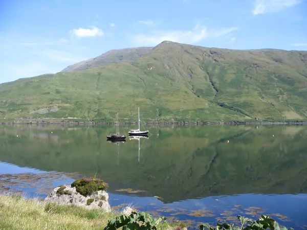
A 700 m blue peak on the north side of Killary Harbour, a glacial fjord, that far more people photograph from the far shore than ever climb. In 2016 a hillwalker found a 5,000-year-old burial chamber high on the mountain. The upland ground is pathless and exposed, so view it from public stops and choose a marked trail if you want a walk.

Castlebar, mayo
The Castlebar Greenway's essential stretch is the 7.3 km riverside route from Lough Lannagh to the National Museum of Ireland – Country Life at Turlough. It is flat, traffic-free and ends at a free museum in a Victorian demesne. The wider 45 km network beyond it leans on on-road links.

Dún Chaocháin, mayo
Dún Chaocháin is a stretch of Irish-speaking coast in the far north-west of Mayo, where sea cliffs of ancient schist meet blanket bog. Waymarked loop walks, the Táin Bó Fliodhaise heritage trail and a community co-op that has kept the language and place-names alive are the draw – along with the fact that almost nobody else is here.
Glennacally, mayo
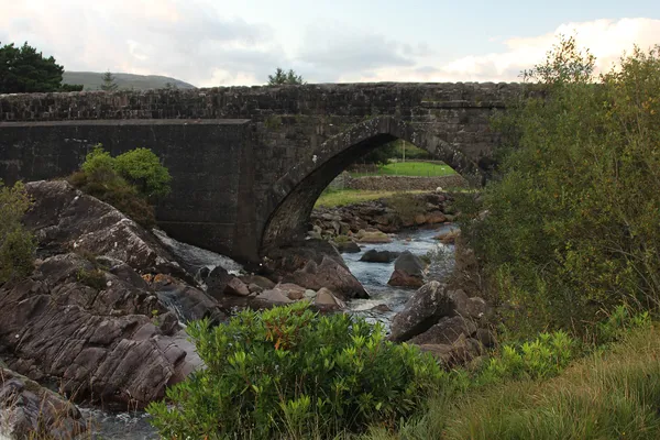
Glennacally is a remote valley in the Partry and Maumtrasna mountains of south Mayo. Its stone road bridge over the Glennacally River is recorded as a design by Alexander Nimmo. The surrounding mountain ground is exposed and approaches can cross private land, so choose a published route with a designated start.

Termon Hill, mayo
Glosh Signal Tower formed part of a coastal warning network. See other parts of the peninsula from signed public routes and leave the tower and fields undisturbed.

Ashford Castle, mayo
Ireland's School of Falconry, founded in 1999 in the grounds of Ashford Castle near Cong, is the oldest falconry school in the country. On the one-hour Private Hawk Walk you fly a trained Harris hawk free through the castle woods and gardens, with a falconer alongside. It runs by appointment only, from about €80 per person, and is open to anyone aged seven and up.

Cong, galway
Straddling the wild lakes and limestone karsts of western Galway and Mayo, Joyce Country Geopark reveals 700 million years of geological history alongside living Irish-language traditions. Hike rugged mountain passes, cycle traffic-free greenways, and explore heritage villages that have inspired poets, filmmakers and anglers for generations.

Belmullet, mayo
Kilgalligan sits on the edge of Broadhaven Bay in the Erris Gaeltacht. The waymarked Benwee Head loop from Carrowteige gives views of the cliffs and the Stags of Broadhaven, but it covers exposed ground and is best saved for settled weather.
Westport, mayo
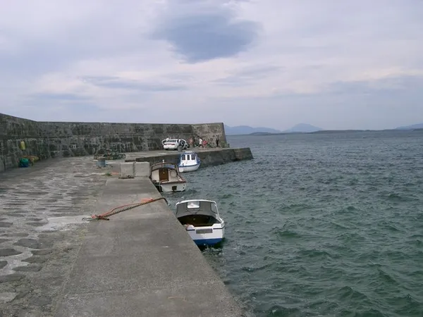
Lecanvey is a quiet village on the south side of Clew Bay between Westport and Louisburgh, near the lower slopes of Croagh Patrick. Its pier gives a view across the bay. Follow the council's beach rules and keep the working pier clear.
Srahrevagh, mayo
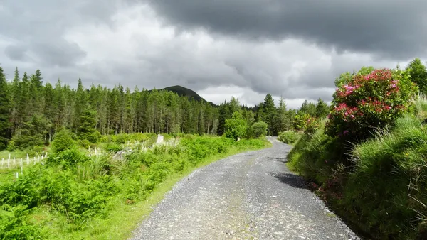
The trees are a 1950s commercial plantation, but Letterkeen is the way into some of the loneliest hill country in Ireland. Three colour-coded loops climb from the stone Brogan Carroll Bothy into the Nephin Beg mountains above Clew Bay, and the surrounding wilderness is now part of Wild Nephin National Park and Mayo's Dark Sky Park.
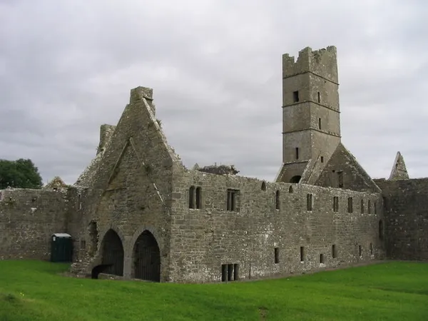
Ballina to Killala, mayo
A 14 km greenway and quiet-lane route links four medieval monastic ruins along the River Moy between Ballina and Killala. Rosserk Friary keeps a climbable bell tower and a rare carved double piscina; Moyne Abbey, just up the road, was a Franciscan provincial school before Sir Richard Bingham's men sacked both in the 1590s. Free, and best on a bike.

Newport, mayo
Newport sits midway on the Great Western Greenway, on the shore of Clew Bay. Its church holds the last window Harry Clarke designed, a seven-arch sandstone viaduct crosses the river, and the town is the main gateway to Ireland's only Gold Tier Dark-Sky Park.

Ballycroy Visitor Centre, mayo
The Tóchar Daithí Bán is a gentle loop of just under 2 km – 30 to 40 minutes on gravel and boardwalk – and the one trail in Wild Nephin you can walk in a wheelchair or with a buggy. It climbs to Cleary's Hill for views over the Nephin Beg mountains, Achill Island and Blacksod Bay, and passes a bog dipping pond on the way. It sits inside a Gold-Tier Dark Sky Park, so it's as good after dark as by day.

galway
The Western Way runs 179 km from Oughterard to Ballycastle, crossing the Maumturks at the Mám Éan pilgrimage pass, skirting Killary fjord and Croagh Patrick, and threading the bog country of the Nephins. Most walkers take about seven days; the two-to-three-day Galway leg is the scenic pick.
Carrowkennedy, mayo
Glenamoy, mayo
North Mayo Coast, mayo
Castlebar, mayo
← All things to do in County Mayo
Book tours & tickets
We may earn a commission if you book through this link, at no extra cost to you.
Book tours, skip-the-line tickets and day trips with GetYourGuide. Free cancellation on most experiences.
See tours & tickets in County Mayo →