
Overview
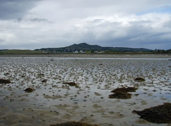
Island Roy, or Oileán Ruaidh, lies in Mulroy Bay near Downings and Carrigart in north-west Donegal. It is a small island of green fields, rocky shore and low, gravelly ground, joined to the mainland by a causeway that the tide covers. Ruaidh means ‘red’, and the name is said to come from the rust colour the island’s vegetation takes on in winter. From the mainland shore you can look across to the island, with the dunes at Rossapenna, the Fanad Mountains and the Donegal hills behind.
People live and farm on the island, so treat it as a community rather than a visitor attraction. Stay on the mainland for a coastal outing and leave the island’s fields and lanes to the residents.
History
The island’s older Irish name, Oileán na Bhráighe, means ‘island of the prisoners’. People have lived here for centuries, and many residents trace their families back several generations. The English name ‘Island Roy’ is an anglicisation of the Irish.
In the early 19th century Lord Leitrim tried to clear the tenants and turn the land over to cattle. A woman holding a 99-year lease is said to have refused to go, and the community stayed.
The causeway that links the mainland at Rannach to the islet of Carraig an Ghóilín and on to Island Roy was built in 1927. It still floods at high tide, so the island can only be reached for a limited time around low water.
In 2010 NASA’s Opportunity rover examined an iron-rich meteorite on Mars. The mission team informally named it Oileán Ruaidh, after the Irish name of the island. The island is sometimes described as being twinned with Mars because of it.

What to see
The best view of Island Roy is from the mainland shore, looking across the tidal flats to the island’s fields and the Mulroy coast beyond. The rocky shores and meadows around the island are nesting ground for gulls, terns and waders, and seaweed grows thick on the low beaches.
The island’s fields, lanes and shore are home and farmland for the people who live there. This page does not describe walking routes on the island, and you should not treat it as open ground for wandering.
For a public shore stop nearby, visit the beach and harbour at Downings. Use the signed approaches and keep clear of harbour operations.
Visiting tips
- Tides first: the causeway is covered by the tide, and misjudging it can leave you stranded or caught on a flooding road. If you are not certain of the tide, stay on the mainland.
- Respect the community: the island is lived in and worked. Keep to the mainland viewpoints and the public shore at Downings.
- Accessibility: the causeway is uneven gravel, so it is not suited to anyone with limited mobility or to buggies.
- How long: a look across from the mainland and a stop at Downings makes a short outing.
Practical information
Access
A tidal causeway links the mainland at Rannach to Carraig an Ghóilín and on to the island, and the tide covers it. The island is a residential community, so use the mainland and the public beach and harbour at Downings for your visit.
Admission
There is no admission to look at the island from the mainland shore.
More information
The NASA Photojournal entry describes the Oileán Ruaidh meteorite.
Seasonal notes
In winter the vegetation turns rust-red, which is the island at its most photogenic from the mainland and the colour behind the name. Tide times change through the day and the year, so check a tide table before planning any shore visit.
Nearby
Back on the mainland there are the beaches at Downings, the ruins of Doe Castle, and further out the Fanad Lighthouse on the Fanad Peninsula. Carrigart has cafés and walking routes.