Islands in County Donegal

Two ferry routes carry most of the visitors on this list. Tory lies 11 km off the north-west coast, about 45 minutes out of Magheroarty and answering to the tide; there are no cars, Irish is the daily language, and the eastern end holds Dún Bhaloir and the cliff spur of An Eochair Mhór, where puffins, razorbills and guillemots nest. Arranmore is a much shorter hop, 15 to 20 minutes from Burtonport, with the 14 km Arranmore Way and a clifftop lighthouse. Gola, off the Gweedore shore, is car-free, with two white-sand beaches and granite cliffs that climbers rate.

The northern Inishowen entries are mostly for looking at. Glashedy stands a mile off Pollan Strand near Ballyliffin, ringed by reefs, best seen from the strand, the golf links or the Wild Alpaca Way at Malin Head. Inishtrahull, six miles beyond the head, has no ferry at all and needs a charter boat and settled weather. The Isle of Doagh you simply drive onto.

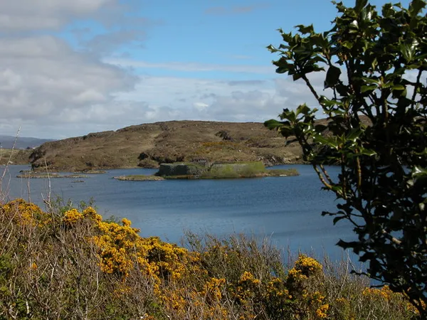
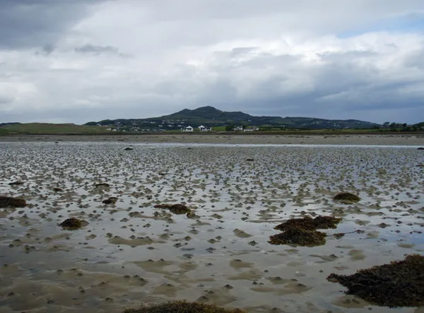
The rest are tidal or inland. Inishkeel is walked from Narin either side of low water, Island Roy and Red Island sit behind causeways that flood, Inch Island is reached by 1850s railway embankments and fills with geese and whooper swans from autumn, and Doon Fort in Loughadoon needs a boat hired locally in summer.

Where to start

  1. Tory Island – Donegal's remotest island

    Eleven kilometres offshore with no cars and Irish as the daily language, it rewards the 45-minute Magheroarty crossing with cliffs, a round tower and a painting tradition.

  2. Arranmore Island – lighthouse and trails

    Donegal's largest inhabited island is only 15 to 20 minutes from Burtonport, a working Gaeltacht with the 14 km Arranmore Way and a clifftop lighthouse.

  3. Glashedy Island – off Ballyliffin

    An uninhabited quartzite outcrop a mile off Pollan Strand, ringed by reefs, it shapes every view from Ballyliffin's beach and golf links.

15 of 15 shown — tap a pin for the place.

Aerial view of Tory Island, Co Donegal
Aerial view of Tory Island, Co Donegal ©Tourism Ireland

Tory Island – Donegal's remotest island

donegal

Tory Island lies 11 km off Donegal and keeps its own rhythm – no cars, Irish as the daily language, and until 2018 its own elected king. The pull is the wild eastern end, Dún Bhaloir, the cliffs and the Wishing Stone, along with a round tower, a rare Tau cross, and a school of local painters started by Derek Hill. The ferry from Magheroarty takes about 45 minutes and answers to the tide.

🌳 Outdoor
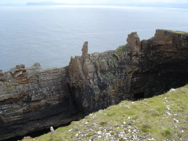
Balor's soldiers - geograph.org.uk - 379338
Balor's soldiers - geograph.org.uk - 379338 Kay Atherton / Wikimedia Commons / CC BY-SA 2.0

An Eochair Mhór – Tory Island's Big Key

Tory Island, donegal

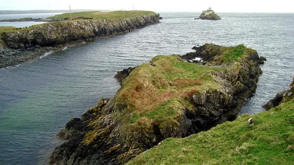
An Eochair Mhór, the 'Big Key', is a long, steep-sided cliff spur on the east side of Tory Island, ending in a crag the islanders call An Tor Mór. Its jagged pinnacles are known as Balor's soldiers, and the cliffs below hold nesting puffins, razorbills and guillemots. Reaching it means a 45-minute, weather-dependent ferry from Magheroarty and a walk along an unfenced coast path.

🌳 Outdoor
Inch island donegal
Inch island donegal Pampuco / Wikimedia Commons / CC BY-SA 4.0

Inch Island – Donegal's wildfowl reserve

Lough Swilly, donegal

Inch Island sits in Lough Swilly, reached by two railway embankments thrown across the water in the 1850s. Its wildfowl reserve is where Iceland-bound whooper swans make their Irish landfall each autumn, and it holds internationally important numbers of Greenland white-fronted and greylag geese through the winter. A 15th-century O'Doherty castle stands on the south-west shore.

🌳 Outdoor 🅿️ Free Parking
Inishtrahull Lighthouse, County Donegal
Inishtrahull Lighthouse, County Donegal @Tourism Ireland by Gardiner Mitchell

Inishtrahull – Ireland's northernmost island

Off the coast of Malin Head, donegal

Six miles north of Malin Head, Inishtrahull is Ireland's most northerly island, built on 1.7-billion-year-old gneiss (the oldest known rock in the country) and topped by its northernmost lighthouse. The last islanders left in 1929 and there is no ferry, so you reach it by charter boat, weather permitting.

🌳 Outdoor 🐕 Dogs Welcome
Island Roy from near Fegart - geograph.org.uk - 1431203
Island Roy from near Fegart - geograph.org.uk - 1431203 David Baird / Wikimedia Commons / CC BY-SA 2.0

Island Roy – tidal island, Martian twin

Carrigart, donegal

This 90-acre island in Mulroy Bay is joined to the Donegal mainland by a causeway built in 1927 that disappears under the sea at high tide. Around 26 people still live here by farming and shellfish. In 2010 NASA named an iron-nickel meteorite on Mars Oileán Ruaidh after the island, for the rust colour its winter vegetation shares with the rock.

🌳 Outdoor
View of Carrickbrachy an old Irish foothill of the (improperly called) Isle of Doagh drawn as looking towards Dunnaff Head by Sir William Smith in 1802
View of Carrickbrachy an old Irish foothill of the (improperly called) Isle of Doagh drawn as looking towards Dunnaff Head by Sir William Smith in 1802 Captain Sir William Smith, member of the Royal engineers / Wikimedia Commons / Public domain

Isle of Doagh – castle and famine village

Inishowen Peninsula, donegal

The Isle of Doagh, a former island now tied to the Inishowen mainland by a silted channel, packs a lot into a small headland: one of Ireland's largest clusters of Neolithic rock art, the free-to-roam ruin of Carrickabraghy Castle, and the family-run Doagh Famine Village, an outdoor museum of 19th-century rural life.

🌳 Outdoor 🅿️ Free Parking
Carntullagh Head and Rotten Island - geograph.org.uk - 1217158
Carntullagh Head and Rotten Island - geograph.org.uk - 1217158 louise price / Wikimedia Commons / CC BY-SA 2.0

Rotten Island – Killybegs harbour light

Rotten Island, donegal

Rotten Island Lighthouse has marked the entrance to Killybegs Harbour since 1838, a 14-metre granite tower still working as an automated harbour light. George Halpin designed it for the Ballast Board, and three of the workmen drowned during its construction in 1836. The island is uninhabited with no ferry, so the best views are from the Killybegs waterfront, Carntullagh Head, or a seasonal boat trip.

🌳 Outdoor 🅿️ Free Parking
Tarent Street, Rutland Island built 1789 - geograph.org.uk - 566542
Tarent Street, Rutland Island built 1789 - geograph.org.uk - 566542 malcolm hurley mills / Wikimedia Commons / CC BY-SA 2.0

Rutland Island (Inis Mhic an Doirn)

donegal

William Burton Conyngham built a planned herring port on Rutland Island in 1784. The herring vanished within years, the village emptied, and the last islanders left in the 1960s. What remains is a low, uninhabited Gaeltacht island of dunes, seal-haunted reefs and holiday cottages, reached by a short boat trip from Burtonport.

🌳 Outdoor

Questions people ask

Which Donegal islands have a passenger ferry?
Tory runs from Magheroarty and takes about 45 minutes, Arranmore from Burtonport takes 15 to 20 minutes, and Gola is a short crossing from the Gweedore shore. Inishtrahull has no ferry and needs a charter boat. Glashedy and Rotten Island have no landing at all.
Which ones can I reach without getting on a boat?
The Isle of Doagh is joined to Inishowen by a silted channel, Inch Island by two 1850s railway embankments, and Island Roy by a 1927 causeway that goes under at high tide. Inishkeel is walked from Narin beach on a sandbank around low water.
Where in the county do these islands cluster?
Three groups. The Gaeltacht north-west around Magheroarty, Gweedore and Burtonport covers Tory, Gola and Arranmore. Northern Inishowen holds Glashedy, Inishtrahull and the Isle of Doagh. A third group sits in Mulroy Bay and Lough Swilly, with Doon Fort near Ardara and Rotten Island at Killybegs further south.
Does the time of year matter?
Yes. Ferry and charter crossings are weather and tide dependent, and the boat to Doon Fort in Loughadoon is hired locally in summer only. Inch Island is at its best from autumn into winter, when whooper swans arrive and the geese settle in. Magheroarty's car park fills fast on summer weekends.
Which island suits a walk of a few hours?
Arranmore, for the 14 km Arranmore Way out to the lighthouse, with a short enough ferry to do it in a day. Tory's eastern end and An Eochair Mhór is the rougher option, on an unfenced coast path, and the crossing can change with the weather.

← All things to do in County Donegal

Book tours & tickets

Powered by GetYourGuide

We may earn a commission if you book through this link, at no extra cost to you.

Book tours, skip-the-line tickets and day trips with GetYourGuide. Free cancellation on most experiences.

See tours & tickets in County Donegal →
Advertisement