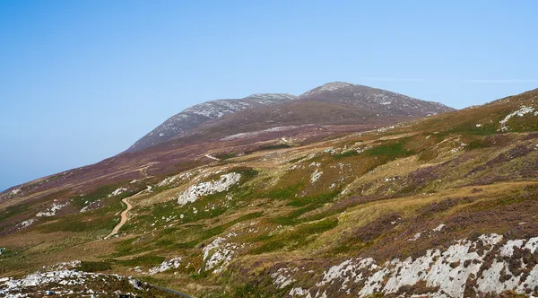
Mountains & Viewpoints in County Donegal

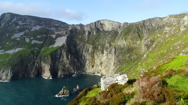
The south-west corner of the county carries the two best known entries here. Slieve League rises 601m out of the sea, and a short walk from the Bunglass car park gives you the full drop without taking on the knife-edge of One Man’s Pass. Inland from Ardara, Glengesh Pass turns up a glacier-cut valley to about 275m on tight hairpins; drive in from the Ardara side so you descend the switchbacks rather than climb them. Barnesmore Gap and the Bluestacks lie east again.

North-west of that, the Derryveagh Mountains hold the densest cluster on the page. Errigal at 751m is the county’s highest, with Glenveagh National Park at its feet and walks running from a kilometre along Lough Veagh to a half-day on the ridge. The Poisoned Glen cuts in below Errigal from Dunlewey, a rough 4km there and back past a ruined white marble church. Muckish, flat-topped at 667m, takes the steep Miner’s Path to its summit cairn. Horn Head’s quartzite cliffs stand about 180m above the mouth of Sheephaven Bay, north of Dunfanaghy.

The rest are drives. Fanad and Inishowen deserve a day each, the Inishowen 100 being a signed 100-mile loop by Malin Head and Grianán of Aileach. Cloud decides everything up here: the long views from Horn Head to Tory Island and Errigal need a clear day, Bloody Foreland earns its name only in the last hour of light, and Crohy Head has one small layby, no facilities and arches reachable only at low tide.

Where to start

  1. Slieve League – cliffs, Bunglass and the Pilgrim Path

    Ireland's second-highest sea cliff at 601m and a fraction as busy as Moher, with a short walk from Bunglass giving the full drop.

  2. Fanad Peninsula – lighthouse and wild coast

    A narrow Gaeltacht peninsula between Lough Swilly and Mulroy Bay, with a climbable headland lighthouse, Blue Flag sand and rugged coastal driving.

  3. Glengesh Pass – Donegal's switchback drive

    A hairpin mountain road climbing to about 275m through a glacier-cut valley between Ardara and Glencolmcille, with a small viewpoint car park.

  4. Horn Head – Donegal's quartzite cliffs Horn Head

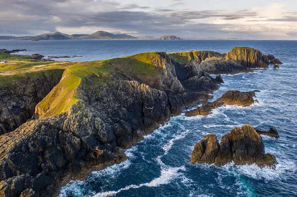
    Quartzite cliffs about 180m above the mouth of Sheephaven Bay, with a clifftop drive and a short walk to the wartime lookout.

  5. Derryveagh Mountains – Errigal & Glenveagh

    The most thinly populated ground in Ireland, rising to Errigal at 751m and wrapping around the free lakes and oak woods of Glenveagh.

26 of 28 shown — tap a pin for the place.

On Slieve League - cliffs & bay at Bunglass
On Slieve League - cliffs & bay at Bunglass Colin Park / Geograph / CC BY-SA 2.0

Bunglass Point – Slieve League's main viewpoint

Cappagh, donegal

Bunglass Point is the main viewing platform for Slieve League in County Donegal, looking across the bay to some of Ireland's highest sea cliffs. Stone slabs spelling ÉIRE from the Second World War sit near the upper car park, and a Napoleonic signal tower stands at Carrigan Head. Check current parking, shuttle and accessible drop-off arrangements before driving up.

🌳 Outdoor
Malin Head, Inishowen Peninsula, Co Donegal
Malin Head, Inishowen Peninsula, Co Donegal Courtesy of Martin Fleming, Failte Ireland

Inishowen Peninsula – Ireland's northern tip

Inishowen Peninsula, donegal

The Inishowen Peninsula holds Ireland's most northerly point, Malin Head, and the two ways to see it are the signposted 160km Inishowen 100 coastal loop and the 14-stop heritage trail. Between them you get Atlantic headlands, the Grianán of Aileach ring fort, Napoleonic coastal forts and long strands like Culdaff.

🌳 Outdoor 🅿️ Free Parking
Muckish Mountain, Donegal 3
Muckish Mountain, Donegal 3 Chris Hill Photographic

Muckish Mountain – Donegal's flat-topped peak

Derryveagh Mountains, donegal

Muckish is the flat-topped peak that dominates north-west Donegal, 667m of quartzite and the second-highest of the Seven Sisters. Its northern flank was mined for high-grade glass sand, and the steep Miner's Path still follows the workers' route to the summit cairn and cross; the gentler climb starts from Muckish Gap by the Bridge of Tears. Low-level looped walks along the old Burtonport railway suit families.

🌳 Outdoor 🅿️ Free Parking 🐕 Dogs Welcome

Questions people ask

If I only have time for one, which should it be?
Slieve League, in the south-west. At 601m it is Ireland's second-highest sea cliff, far quieter than Moher, and the walk from Bunglass gets you the full view in a short outing. Only the sure-footed need continue over One Man's Pass.
Where in Donegal do most of these cluster?
The thickest group is in the north-west around the Derryveagh Mountains: Errigal, Glenveagh, the Poisoned Glen at Dunlewey, Muckish and, on the coast, Horn Head and Bloody Foreland. The south-west holds Slieve League, Glengesh Pass, Barnesmore Gap and the Bluestacks.
Can I combine Slieve League and Glengesh Pass in one day?
Yes. Both sit in south-west Donegal, and Glengesh runs between Ardara and Glencolmcille on the way through. Take the pass from the Ardara side so you descend the switchbacks, and allow time for the walk out from Bunglass at Slieve League.
Which of these work without much walking?
Glengesh Pass and Barnesmore Gap are roadside viewpoints with lay-bys, Horn Head has a clifftop drive, and the Inishowen 100 and Fanad are full driving loops. Bloody Foreland's signed coastal walk is only 1.5km, with free parking at the trailhead.
When is the best time of day to go?
Bloody Foreland is worth timing for the hour before sunset on a clear evening, when the rocks turn red. Horn Head's long views to Tory Island, Errigal and Muckish need clear air at any hour, and Crohy Head's beach arches are reachable only at low tide.

← All things to do in County Donegal

Book tours & tickets

Powered by GetYourGuide

We may earn a commission if you book through this link, at no extra cost to you.

Book tours, skip-the-line tickets and day trips with GetYourGuide. Free cancellation on most experiences.

See tours & tickets in County Donegal →
Advertisement