
Overview
Lettermore is not one island but two joined halves: eastern Leitir Móir (“great rough hillside”) and western Leitir Calaidh, Lettercallow. Both sit among the cluster of Irish-speaking islands that locals call Ceantar na nOileán, the district of the islands. A road causeway, the R374, links the lot to the mainland. There is no single sight to tick off here. The point of Lettermore is the drive and the language: this is a Gaeltacht community where Irish is the everyday language, and a slow run along the shore is the best way to take it in.
Come for that, not for the facilities. Do not expect a string of cafés or a signed beach with a car park, and expect the mobile signal to be patchy in places.
Getting to Lettermore
Follow the R374 from Casla across the causeway. The road continues to Gorumna and Lettermullen, past low stone walls and tidal inlets. It is narrow in places, so allow extra time, leave space on narrow sections and keep passing places and entrances clear.
Bus Éireann route 424 runs between Galway and Lettermullen. Check the stops and return departures for your date, as services can be limited. The nearest railway station is Galway City, from where you connect by bus or car.
History & The Connemara Pony
For centuries the thin, stony ground shaped both the people and the animals bred on it, and Lettermore has a strong claim to be part of the heartland of the Connemara pony, a hardy, sure-footed breed that has become a symbol of the whole region.
Its origins are argued over. Some trace it to Scandinavian stock brought by Viking settlers, others to the extinct “Irish Hobby” workhorse, while local legend has it that Andalusian horses swam ashore when Spanish Armada galleons wrecked off the Galway coast in 1588 and bred with the native stock. Whatever the truth, the pony is still bred and shown in Connemara, and it is the thread that ties the island’s farming past to its present.
What to See & Do
Walking and the coast
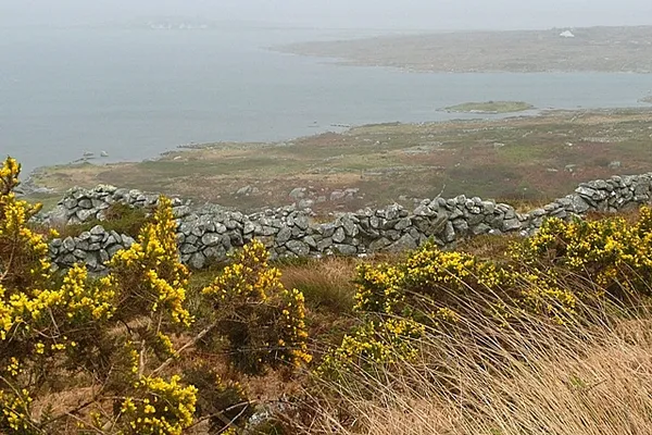
The R374 winds between boulders and tidal water, and from the roadside you get open views across the bays and out towards the Atlantic. For a walk off the main road, use the waymarked Lúibín Gharmna loop from Tír an Fhia on Gorumna, and check the trail listing before setting out.
Much of the shore is rough, rocky and tidal. Stay on public roads and waymarked routes, keep off private land, and check the weather and tide before you go near the water. Do not swim without local advice, as currents can shift fast.
Culture and heritage
A visit here is as much about the language as the landscape. If you try a cúpla focal (a couple of words) in Irish, you will usually get a warm response. For the island’s story, the Lettermullen and Gorumna Heritage Centre covers local life, including farming, fishing and emigration. Check opening arrangements before you go.
Practical Information
When to visit
Summer has the longest daylight and the mildest weather. Spring and autumn are quieter, but pack a waterproof and sturdy shoes, because Atlantic weather turns quickly and rocky, wet ground gets slippery.
Accommodation and services
Check accommodation options before you travel. Carry some cash in case smaller places do not take cards, and download offline maps, since mobile signal and Wi-Fi can be patchy.
Accessibility
The natural ground here, including uneven stone paths and unpaved lanes, is hard going for wheelchair users and anyone with limited mobility. Public transport is limited, so a car or bicycle is the most reliable way to explore. Check directly with any accommodation or attraction about access.
If you only do one thing, take the slow drive out along the R374 on a clear afternoon, look across the water, and give yourself time to talk to whoever is about in the village.