
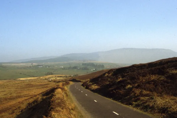
The southern Comeraghs, and why nobody calls them that
The Monavullagh Mountains form part of the southern Comeragh range in County Waterford, and hardly anyone uses the name. Locals talk about the individual summits, or just say the Comeraghs; Monavullagh, from the Irish Móin an Mhullaigh, ‘bog of the summit’, has sat on Ordnance Survey maps since the 19th century without ever settling into everyday speech.
This is serious hill country, not a stroll. The tops are boggy, paths fade, and cloud can drop over the plateau in minutes. In low cloud the open hills can be difficult to navigate, so plan any upland walk around confirmed public access and suitable weather.
The walk to Seefin
Seefin is the high point at 726m, and a narrow ridge connects it to Farbréaga, the ‘false man’, at 617m. From the high ground the land falls away towards the Mahon valley, Dungarvan Bay and the sea beyond. Being able to navigate off a map when you cannot see fifty metres matters more here than fitness, and anyone heading onto the tops should check access and conditions first.
A waymarked walk nearby
For a shorter outing, follow the Mahon Falls walk from the signed public car park. The path takes you into Coum Mahon, where the River Mahon drops from the plateau into a glacial valley. Stay on the path and give the falls and rock edges space.
A Bronze Age hillside, and a coin from Central Asia
The western foothills hold more than they let on. Archaeologists have mapped a Bronze Age settlement and ritual complex spread across roughly four square kilometres of these slopes. On the same western ground, someone once turned up a Kushan coin, struck by a dynasty that ruled in Central Asia two thousand years ago. Nobody can say how it reached a Waterford hillside. Even as a hint of long-distance contact, direct or third-hand through a dozen sets of hands, it is a strange thing to find in the heather.
The Colligan River rises up here too, then runs south off the range down to Dungarvan.
Wildlife
The birds are the draw for anyone carrying binoculars. Hen harrier quarter the moorland, and peregrine, raven and buzzard all work the crags and open ground. Ground-nesting birds are on eggs in spring and early summer, so keep to the path and keep any dog close.
Getting there and staying safe
Use the signed public car park for the Mahon Falls walk, and leave private gates and roadside entrances clear. Check current conditions before you set out.
Carry the OS Discovery Series Sheet 75 and a compass, and know how to use both: the open hills have sheer drops on the coum edges and peat hags that hide deep water. It is no place for young children or for anyone new to mountain navigation. Sturdy boots, waterproofs and spare warm layers go in the pack whatever the forecast promises.
Nearby
- Comeragh Mountains – the wider range, with Coumshingaun’s cliff-ringed lake the standout.
- Copper Coast Geopark – a drive south to sea cliffs, fossil beaches and coastal walks.
- Mahon Falls – an easy add-on before or after the hill, on its own signed walk.
Check the mountain forecast the night before, not the morning of. Up here the difference of a few hours often decides whether you see anything at all.