
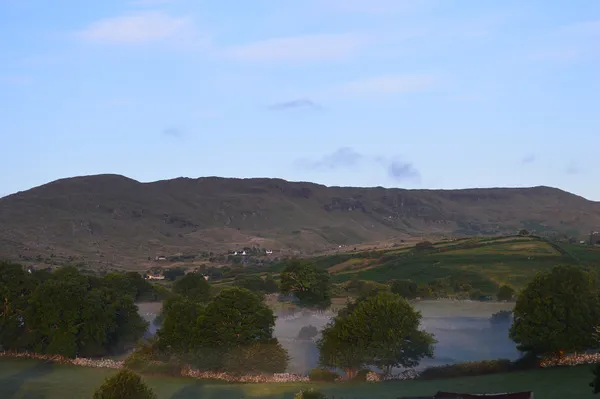
Mount Gable, known locally as Binn Shléibhe and rising to 417.8 m (1,370 ft), sits on the narrow neck of land between Lough Corrib and Lough Mask, close to the Gaeltacht village of Clonbur (An Fhairche) in County Galway. It is a modest hill with an outsized view, and the old road that runs below it makes a rewarding walk.
The walk
The Mount Gable Walk follows the Seanbhóthar, the old road between Clonbur and Corr na Móna. It runs along the side of Binn Shléibhe, with Lough Corrib below. The regional walking map gives 10 km and about two and a half hours for the linear route. There is a steep section at each end. Some walkers turn it into a loop, but that is not a signed or official circuit.
The old road passes below the summit. The open hill is a separate outing over peat bog and heather with no waymarking, requiring navigation and suitable weather. Save it for a clear day and skip it in fog or low cloud. The ground can be marshy after rain, so wear boots you do not mind getting wet.
The ruins and the stories
The stone foundations along the old road are the remains of a village abandoned around the famine years, the cottages clustered tight and angled to catch shelter and sun. The first ruin you reach is associated with ‘Maidhc Ned’, who – like so many from here – left for work in England; he appears in Dónall Mac Amhlaigh’s Dialann Deonaí. Look for Baile Dhubh Loch below the road before the rise that opens out over Lough Corrib. Older layers cling to the same ground: the Seanbhóthar is said to trace a route St Patrick took towards Maméan, and tradition puts the Firbolg on this hilltop before their legendary clash with the Tuatha Dé Danann at Moytura.
Practical tips
- Trail conditions: the old road is generally easy apart from the steep section at each end. The open hill above is peaty, unmarked and best avoided in fog or heavy rain.
- Return journey: arrange a way back before you set out, as the walk is linear. Local Link route 431 serves both villages, so check stops and times for your walking direction.
- Facilities: none on the hill. Back in Clonbur there is a shop and a pub or two for supplies.
- Navigation: bring a phone map or a paper map if you leave the old road.
- Weather: Connemara’s weather turns fast, and there is little shelter. Pack a waterproof, layers and a snack.
Getting there and nearby
Clonbur sits on the N59 roughly halfway between Galway City and Oughterard. If driving, use designated spaces in the villages and keep vehicle barriers and farm access clear.
For a woodland walk, the Clonbur Wood loop follows signed trails near Lough Mask, with views over the lake and the ruins of Ballykine Castle. The Quiet Man Museum in Cong covers the region’s film history. If the wind is up or the cloud is down, skip the open hill and choose the woods instead.