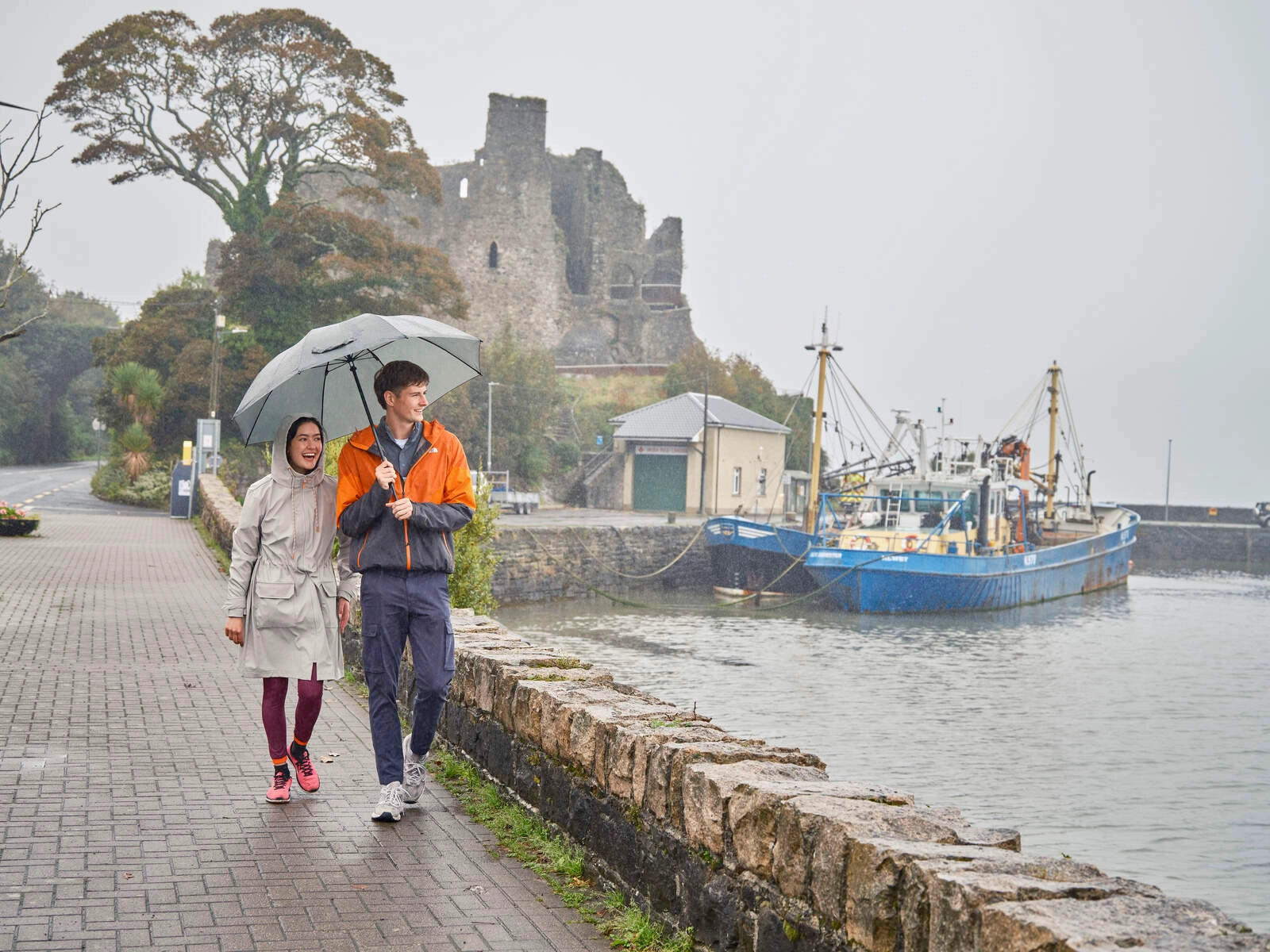
Tucked away on Ireland's ancient east coast, where the Cooley Peninsula meets the shimmering waters of Carlingford Lough, lies a village that time seems to have forgotten. Omeath, with its sweeping views of the brooding Mourne Mountains, feels like a secret waiting to be discovered.
This isn't your typical tourist hotspot – and that's exactly what makes it special. While crowds flock to better-known Irish destinations, Omeath offers something increasingly rare: authenticity. Here, you can still find yourself alone on a hillside trail, watching seals play in the lough below, or chatting with locals in a pub that's been serving pints since the 1860s.
The village's story reads like an Irish folklore tale. Named after Muireadheach Méith ("the fat one"), Omeath was once a crucial Viking lookout point. Monks posted sentries on what's now known as Flagstaff Hill, raising warning flags at the first sight of approaching longships. Today, that same vantage point offers visitors one of Ireland's most spectacular views – a panorama stretching across Carlingford Lough to the mighty Mourne Mountains.
History here isn't confined to museums – it's etched into the landscape. Nearly 30 prehistoric ringforts dot the surrounding countryside, some dating back 4,000 years. The village itself holds the distinction of being one of the last places in County Louth where Irish was spoken naturally, until the passing of its final native speaker in 1960. You can still hear echoes of this linguistic heritage in the local place names and stories.
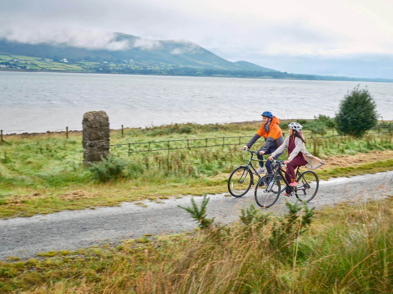
For outdoor enthusiasts, Omeath is a playground waiting to be explored. The recently completed Carlingford Lough Greenway offers a stunning 7km coastal path perfect for cycling or walking. More adventurous souls can tackle the hiking trails leading to Foxes Rock, where the reward is a view that makes every step worthwhile. In summer, the lough comes alive with kayakers and paddleboarders, while year-round fishing draws anglers hoping to land cod, whiting, or plaice.
Things to Do in Omeath
The Long Woman's Grave
This ancient landmark, also known as "The Cairn of Cauthleen," is shrouded in local legend. It is said to be the burial place of a Spanish noblewoman named Cauthleen who was tricked into marriage by Lorcan O'Hanlon, the youngest son of the Chieftain of Omeath. Lorcan, captivated by Cauthleen's beauty, promised her a life of luxury in his homeland. However, upon reaching Omeath, Cauthleen was devastated by the reality of her situation and died of a broken heart. Overcome with guilt, Lorcan drowned himself in a nearby marsh. The locals, moved by Cauthleen's tragic fate, buried her in the "Lug Bhan Fada" (Long woman's hollow) and each placed a stone on her grave to create the cairn that stands today.
Proleek Dolmen
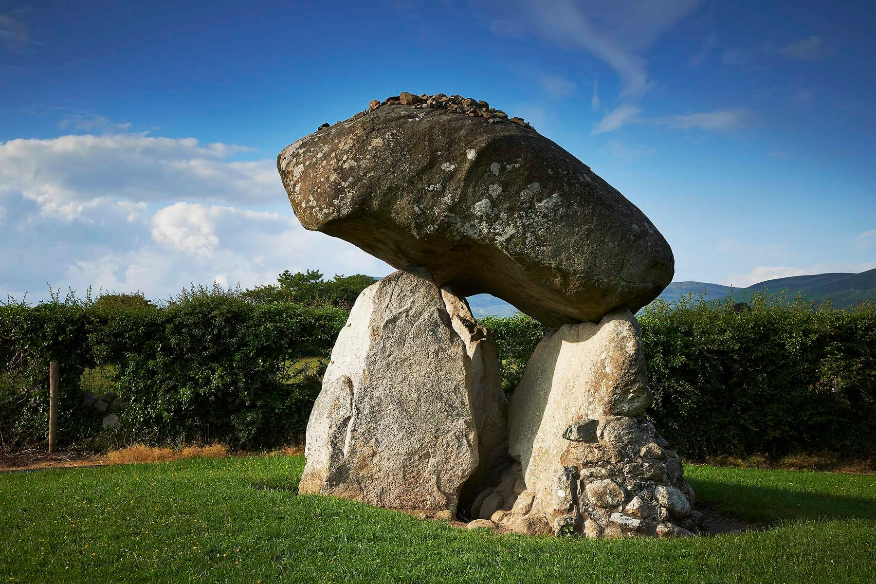
Located near Dundalk, this ancient portal tomb dates back to the Neolithic period (around 3000 BC). It's a fascinating site for history buffs and those interested in Ireland's ancient past. The Proleek Dolmen is one of the most impressive and photogenic dolmens in the country, with its massive capstone estimated to weigh approximately 35 tons. Local legends add to the mystique of this ancient monument, with tales of a Scottish giant carrying the tomb to Ireland and a belief that anyone who can throw a pebble onto the capstone and make it stay there will be married within the year.
Flagstaff View
Located in Cornamucklagh, Flagstaff View offers breathtaking panoramic views of Carlingford Lough, the majestic Mourne Mountains, and the historic Newry Canal. This vantage point provides a unique perspective on the Cooley Peninsula's diverse landscape, from the rugged coastline to the rolling hills and the tranquil waters of the lough. It's an ideal spot for photographers, nature enthusiasts, and anyone seeking a moment of tranquility amidst stunning scenery.
The Calvary
This historic site is a place of peace and reflection, offering a spiritual retreat amidst natural beauty. It features a Shrine of St. Jude, the patron saint of hopeless cases, where visitors can offer prayers and seek solace. The Calvary also includes a Way of the Cross, a Lourdes Grotto, and the Fr. Gentili Crypt and Gardens, providing a serene environment for contemplation and spiritual renewal.
Omeath Pier
Take a stroll along the pier and enjoy the fresh sea air while admiring the views of the lough. You might even spot some local wildlife, such as seals or seabirds.
Howe's Bar (Bay View Tavern)
This iconic pub has been serving the Omeath community since the mid-1860s. It's a traditional Irish pub with a friendly atmosphere and a great selection of drinks. Howe's Bar has also won the Louth County Council's Tidy Towns award for best pub shop front for five consecutive years (2010-2015), highlighting its commitment to quality and community spirit.
The Foxes Rock
Embark on a moderate hike to Foxes Rock and enjoy stunning views of the surrounding countryside. The trail starts from the Long Woman's Grave at Windy Gap and climbs up to Foxes Rocks, offering a rewarding challenge for outdoor enthusiasts.
Carlingford Lough Greenway

This 7km pathway follows the shoreline between Carlingford Marina and Omeath, offering a scenic route for walking or cycling. It's a great way to explore the area at your own pace and enjoy the fresh air and beautiful scenery.
A Brief History of Omeath
Omeath has a rich history, dating back to the Mesolithic period (around 6000 BC). Archaeological evidence suggests that people have lived in the area for thousands of years, drawn by the fertile land and abundant resources of the Cooley Peninsula. The area is also home to nearly 30 prehistoric ringforts, known as lios (Lislea), rath, dun, or caiseal. These structures, which could be anywhere from 1,000 to 4,000 years old, were designed to protect single farmsteads or small groups of houses.
The village itself sprang up around the old Omeath railway station in 1876. While it attracted day-trippers and tourists, it never grew into a major residential center like nearby Warrenpoint. This is in stark contrast to its earlier history when smuggling was common in the area, especially during World War II, which was known as "The Emergency" in Ireland. Today, Omeath offers a tranquil escape for those seeking respite from bustling city life.
Omeath was also one of the last strongholds of the Irish language in County Louth. The last native speaker of Omeath Irish, Anne O'Hanlon, passed away in 1960. However, recordings of the dialect were made by German linguist Wilhelm Doegen, preserving a piece of the village's linguistic heritage. Interestingly, the hill areas above the village were the last place in Louth where Irish was the spoken language.
The village is named after Muireadheach Méith (méith meaning 'the fat') and was originally called Uí Méith Mara, by the sea, to distinguish it from another Ó Méith named after the same man. The Vikings also played a role in Omeath's history, raiding the nearby Killeavy monastery in 835 AD. To warn of such attacks, monks posted sentries on a hill overlooking the lough, now known as Flagstaff, to watch for Viking ships. If spotted, they would raise a warning flag, giving the monks time to hide their valuables.
Getting to and from Omeath
Road
The village is located on the R173 regional road.
Bus Services
Regular bus services connect Omeath with Newry and Dundalk.
| Route | Operator | Operating Days |
|---|---|---|
| Route 161 | Bus Éireann | Monday to Friday |
| Dundalk and Newry | Halpenny Travel | Sundays |
TFI Local Link also provides bus services in the area, offering both Regular Rural Bus Services and Door-to-Door Bus Services.
Ferry
During the summer months, a foot passenger ferry service operates between Omeath and Warrenpoint in County Down. This provides a scenic way to travel across Carlingford Lough and explore the neighboring town.
Carlingford Lough Greenway
This scenic pathway provides a route for walking or cycling to and from Carlingford.