
Overview
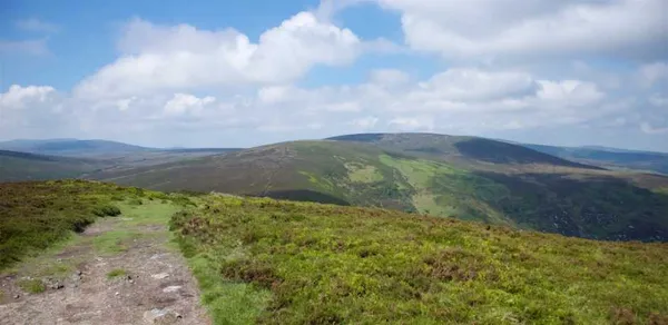
Tonduff means ‘black bottom’ in Irish – Tóin Dubh – and the name suits a flat, peat-dark summit more than it flatters it. At 642 m (2,106 ft) it stands in the far northeastern part of the Wicklow Mountains, County Wicklow. The broad top divides into Tonduff North and the slightly lower Tonduff East Top (593 m). Blanket bog covers the slopes, and the western flank is where the River Liffey begins.
Be honest with yourself about the summit before you set out: it is a wide, viewless plateau, and the interest is in the bog, the birds and the ridge, not the trig-point moment.
Getting there and parking
The higher ground is exposed and can be difficult to navigate in low cloud. Confirm permitted access before setting out and leave the peat undisturbed.
Coillte lists a separate 2.6 km strenuous mountain access route from Crone Woods, near Enniskerry. Use its designated start for that route and check the manager’s notices. The waymarked forest route does not establish a way to Tonduff’s summit, so do not treat it as one, and do not cut across open ground to reach the top.
Public transport is thin. Check current timetables before travelling, and plan how you will get to and from the Crone Woods start, including parking.
What to see
The appeal here is atmosphere rather than rock. The neighbouring land includes Djouce Mountain, Liffey Head Bog and the ground running inland toward Sally Gap.
Underfoot is an old, wet ecosystem. Liffey Head Bog feeds the Liffey on its way to Dublin, while the southern slopes drain toward the River Dargle and Bray. The acid peat supports sphagnum mosses, cotton-grass and carnivorous sundews; meadow pipits and skylarks are common, and golden plover sometimes winter on the higher ground.
Practical information and safety
- Terrain: the higher ground is peat bog, soft, uneven and deeper than it looks. Avoid cutting across open bog, which damages the vegetation and turns ankles.
- Footwear: sturdy, ankle-supporting boots. Trainers and trail runners are a poor idea on wet peat and hidden tussocks.
- Weather: the top is fully exposed and conditions turn fast. Carry a waterproof, a warm layer and a map or GPS.
- Dogs: no confirmed public approach to the summit, so check the manager’s notices on dog rules before you bring one, and keep dogs under close control near ground-nesting birds.
- Facilities: assume there are none on the hill. Bring your own water and food and a charged phone.
- Navigation: in mist the bog is genuinely disorienting. Carry a paper map and the skill to use it.
Nearby
If you are making a day of it, pair the walk with:
- Avondale Forest Park and House – woodland walks and a historic estate to the south.
- Camaderry – a higher, quieter peak above Glendalough.
Choose a clear day when the light lasts, and let someone know your plans and expected return before you head up.