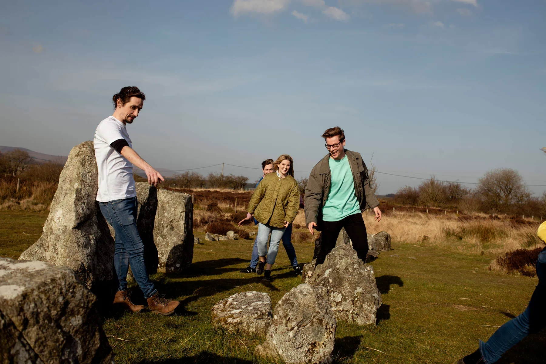
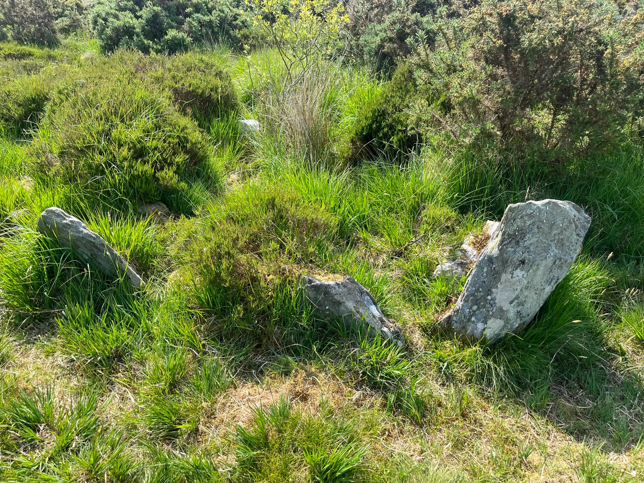
Deep in the rolling hills of County Tyrone, the Beaghmore Stone Circles provide a powerful connection to Ireland's ancient inhabitants. This Bronze Age complex features seven stone circles, ten rows of stones radiating outwards, and twelve cairns (burial mounds), with over 1,269 stones found here since peat cutters stumbled upon them in the 1930s. The name Beaghmore (from the Irish Bheitheach Mhór, "big place of birch trees") suggests the area was once forest, cleared by farmers in the Neolithic era (New Stone Age). What makes Beaghmore special is its mix of history: evidence of early campfires and flint tools dates back to 2900-2600 BC, while the stone structures themselves are thought to be from the Bronze Age, around 2000-1200 BC. This layering of ancient activity makes it one of the most important prehistoric sites in the UK and Ireland.
Many believe the stones have astronomical alignments. Three rows seem to line up with the sunrise on the summer solstice, and another points towards the moon at a specific point in its cycle, suggesting the circles might have been used as ancient calendars or observatories. One particularly intriguing feature is the "Dragon's Teeth" circle, packed with over 800 small upright stones – perhaps representing comets or used in specific rituals. Some stones have faint grooves that look a bit like Ogham script (an early Irish alphabet), though their meaning is unknown – perhaps symbolic, magical, or even practical. Archaeologists noted that the stone rows often seem built over older Neolithic field boundaries, suggesting later inhabitants deliberately reshaped the landscape. A polished axe made from stone found 70 miles away in County Antrim also shows Beaghmore was part of wider trade and ceremonial networks.
Visiting Beaghmore today is a peaceful, almost meditative experience. The wide-open bogland setting makes the stones stand out beautifully against the backdrop of the Sperrin Mountains. You can take guided tours with knowledgeable locals who explain the site's possible astronomy, mythology, and the story of its rediscovery. Some tours even include storytelling or poetry inspired by the stones, and might combine the visit with a trip to the nearby OM Dark Sky Park, highlighting the area's clear night skies, just as the ancients might have experienced. Summer solstice is a popular time to visit, as is winter for stargazing, but the site's quiet majesty can be felt year-round.
What makes Beaghmore truly captivating is its enduring mystery. While theories abound – fertility rituals, lunar calendars, community gathering spots – no one knows for sure why these circles and rows were built. This uncertainty, combined with the haunting atmosphere of the stones and the surrounding landscape, makes you reflect on the lives and beliefs of the people who created this lasting monument thousands of years ago.
Getting There
By Air: The nearest airport is City of Derry (LDY), located approximately 55km away. From here, rent a car or arrange private transport to Cookstown, the starting point for the final leg of the journey.
By Train: The closest train stations are in Dungannon and Omagh. From Dungannon, take a connecting bus to Cookstown, while those arriving at Omagh can drive or take a bus to Cookstown before continuing via the A505.
By Bus: Public buses run from Dungannon and Strabane to Cookstown. Once in Cookstown, visitors must drive west on the A505 towards Beaghmore. Note that bus services in the region are limited, so advance planning is advised.
Driving Directions:
- From Cookstown: Head west on the A505 for approximately 15 minutes. Look for a right-hand turn (signposted) after passing through the village of An Creagán. The narrow, 4-mile (6.4km) road leads directly to the site. The route offers scenic views of the Sperrin Mountains.
- From Belfast: Take the A1 to the A2, then follow signs towards Dungannon. Continue on the A505 westbound towards Cookstown, following the directions above.
- From Derry/Londonderry: Drive south on the A6 to Strabane, then follow the A505 east towards Cookstown.
- From Omagh: Head east on the A5 towards Dungannon, then continue on the A505 towards Cookstown.
Local Transport: No dedicated public transport operates directly to the site. Visitors arriving in Cookstown are advised to rent a car or arrange private transportation for the final journey. The narrow, winding road to the stone circles is best navigated by vehicle.
Parking
Parking at Beaghmore Stone Circles is free and available on-site in a small lot directly adjacent to the site. Spaces are limited and allocated on a first-come, first-served basis, so arrive early during peak summer months to ensure availability. The short 50-meter stroll from the parking area to the stone circles is flat and straightforward, offering easy access for most visitors. While there are no dedicated disabled parking spaces, the level path makes the site accessible for those with mobility aids or wheelchairs. Due to the rural setting, nearby alternative parking is scarce, so plan to use the on-site lot whenever possible. No time restrictions apply, and you can stay as long as needed. For visitors combining this with other Sperrin Mountains attractions, remember to check parking arrangements at neighboring sites in advance.
Pricing
Parking is also provided free of charge at a nearby designated area, ensuring easy access to the stone circles.
Discounts & Passes: No discounts, group rates, or seasonal passes are available, as the site remains free year-round. Similarly, there are no multi-attraction ticket options linked to this location.
Guided Tours/Additional Costs: While no guided tours are officially organized or managed by the Northern Ireland Environment Agency (NIEA), independent guides or tours may occasionally operate in the area. Visitors should inquire locally if interested. There are no on-site facilities or additional charges related to the stone circles themselves.
Payment Methods: No payments are required for entry or parking, so this does not apply.
Nearby Attractions
Ballygroll Prehistoric Landscape
Head to a windswept ridge in County Londonderry to find the Ballygroll Prehistoric Landscape, a remarkable site packed with over 2,500 years of human history, from the Stone Age right through to the L...
Distance: 9.3 km
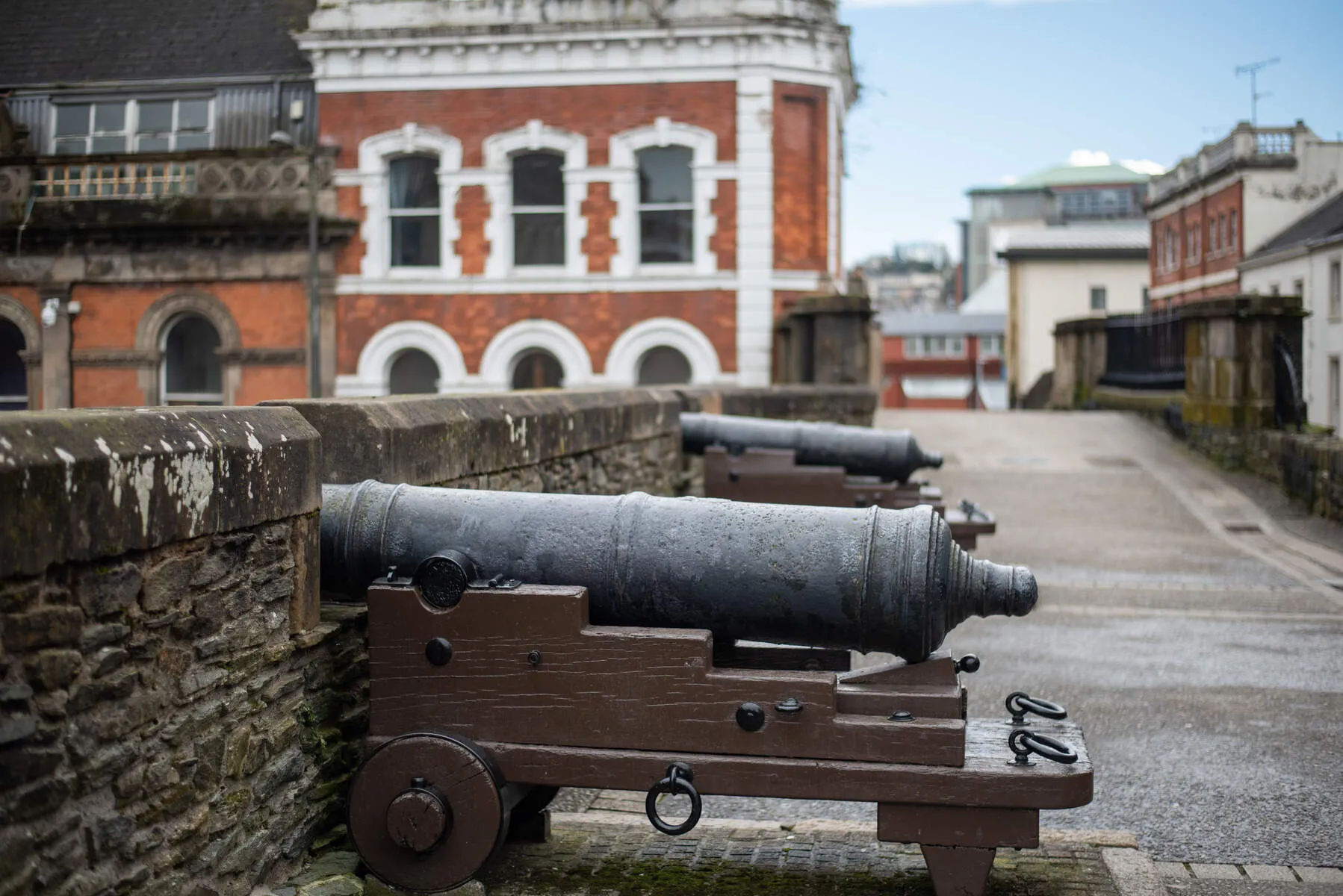
Derry City Walls
Derry City Walls stand as a testament to resilience and history, the last fully intact walled city in Ireland and among Europe's most preserved fortifications. Constructed between 1613 and 1619 under ...
Distance: 36.4 km
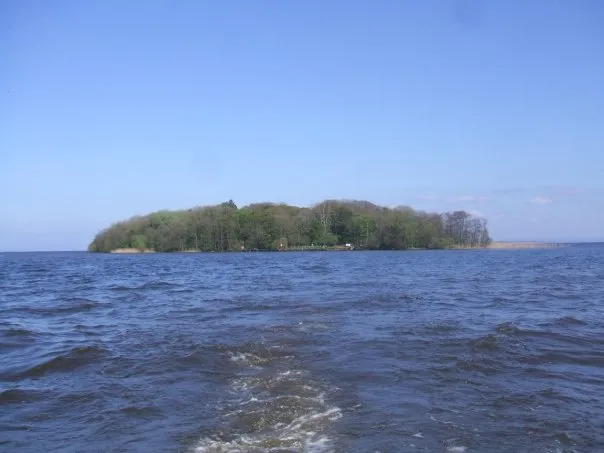
Coney Island (Toome Canal Access)
Coney Island, accessible via Toome Canal in County Antrim, offers a captivating journey into Northern Ireland's natural and historical landscapes. Situated on the shores of Lough Neagh-the largest fre...
Distance: 38.1 km