
Overview
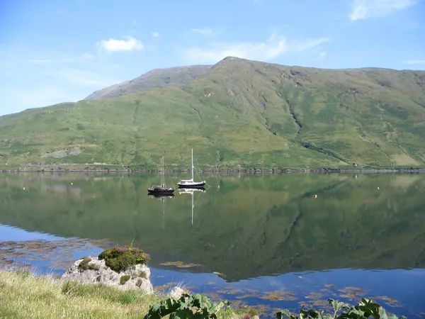
Ben Gorm (Irish: An Bhinn Ghorm, “the blue peak”) is the mountain you see across the water from the Connemara side of Killary Harbour, a broad 700 m wedge on the Mayo shore that plenty of people photograph and very few climb. It rises across the water from Leenane. It heads a small group of peaks with Ben Creggan (693 m) and its South Top, Maul Laur (687 m), and its ridge sweeps inland towards Lough Tawnyard. Geological Survey Ireland describes the steep-sided harbour and shows Ben Gorm in its survey of the landscape.
This is a mountain to admire from below. There is no path to the top and no signpost anywhere on it, and the upland ground is exposed and pathless. If you want a marked walk in the area, choose a published route such as one of the Connemara National Park trails at Letterfrack.
The Ascent & Ridge Walk
There is no waymarked route up Ben Gorm, and this page does not describe one. The slopes are steep and boggy, the upper ridge is rocky and cut by deep fissures, and the approaches run through private land and unofficial roadside pull-ins. The easiest and safest way to enjoy the mountain is to look at it from the harbour, using designated public stops around Leenane and leaving the road and private entrances clear.
Geology & Landscape
Ben Gorm sits on a complex network of Cambrian and Ordovician rock formations shaped by the Caledonian orogeny. The fault lines on the ridge are the surface expression of ancient tectonic activity, later widened by glacial movement during the last Ice Age. The same glacial forces carved Killary Harbour, which lies directly to the south. The mountain’s upper slopes support hardy upland flora including purple moor grass, ling heather and bilberry. Lower elevations transition into blanket bog and mixed woodland, particularly around the Glenummera and Glendavock valleys.
The tomb near the top
In August 2016 a hillwalker, Michael Chambers, came across a stone burial chamber high on Ben Gorm. The bones inside turned out to be more than 5,000 years old, around 3600 BC, making this a Neolithic tomb, and among them was evidence of deliberate skull-smashing, a burial rite the excavation team recognised from other sites of the period. A rescue dig led by archaeologist Dr Marion Dowd followed. It is a rare thing to find a monument like this so high and so far off any path. There is nothing signposted or roped off to see, the exact spot is not publicised, and nobody should go looking for it.
Views from Ben Gorm
In clear weather the outlook from the high ground takes in Killary Harbour cutting inland like a deep blue ribbon, flanked by the peaks of the Twelve Bens. Westward lies the Doolough Valley beneath the face of Ben Lugmore, with Mweelrea anchoring the skyline across Doo Lough. To the north, the Sheeffry Hills and Barrclashcame rise above the Erriff valley. Most visitors get the best of this from the road and the shoreline, where the mountain sits in the frame with the water in front of it.
Getting There & Parking
The R335 connects Leenaun to Westport and runs along the southern base of the mountain. Use designated public stops, leave the road and private entrances clear, and do not rely on informal verges or pull-ins. Check current local signs before you stop. Public transport is limited, so check current Bus Éireann timetables for services to Leenaun.
Safety & Seasonal Advice
The upland ground is exposed, boggy and pathless, and the weather and cloud can change quickly. Mobile signal is unreliable in the hills. Winter conditions bring ice and snow that can hide the fissures on the ridge. Avoid the open slopes in poor visibility, strong wind or ice. The terrain is not suitable for young children or casual walkers.
Nearby Attractions
- Aasleagh Falls – A striking waterfall set in a narrow gorge on the Erriff.
- Ben Creggan – The neighbouring peak in the same group as Ben Gorm.
- Croagh Patrick – A well-known coastal climb to the south, offering a different landscape and cultural context.
- Ballycroy National Park – Located north of the Erriff valley, providing extensive bogland trails and red deer spotting.
Plan your visit around a dry day, and for a walk rather than a view, pick one of the marked trails in the area.