
Overview
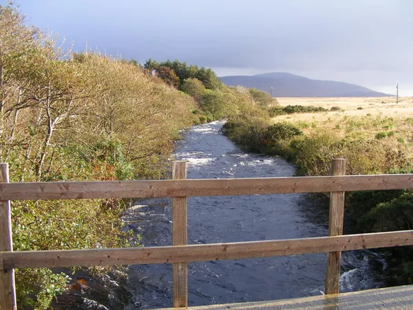
For a river barely 8km long, the Clady keeps unusual company: a 1950s power station affects how much water runs down it. It rises at the western end of Lower Lough Nacung and flows west-north-west across open moorland to meet the Crolly River at Bunbeg Quay, in the Gweedore Gaeltacht of north-west County Donegal. The Irish name, An Chláidigh, means ‘the One Who Washes’ or ‘the Strong-Flowing One’, though after a dry spell it does neither, which is really the whole story of fishing here.
The river is managed as part of the Clady and Crolly fishery. Flows can change with rain and hydroelectric operations.
The hydro-electric heritage
The ESB built the Clady Power Station in the townland of Dore between 1954 and 1959. Water is drawn off at the Gweedore Weir and carried through a 2.7km head-race canal to the turbine house, then returned to the Crolly downstream. The station is listed on Buildings of Ireland. Stay away from working structures such as the weir, canal and turbine house, and keep private banks and gates clear.
That diversion is why the river’s flow can follow a schedule rather than the weather alone. The ESB has released timed pulses of water, known as freshets, to mimic a natural spate and encourage salmon and sea trout to run. Any release programme can change from year to year, so ask the fishery or a local tackle shop about current arrangements before you travel.
Angling on the Clady
Inland Fisheries Ireland lists the Clady as catch-and-release only in 2026. Check current restrictions on bait and hooks, the relevant licence and permit, and where access is authorised on the Clady and Crolly fishery page before you go.
Grilse have traditionally dominated the run from early June, with sea trout numbers building through late summer. Where fish are caught, handle them in the water and release them alive.
Landscape and photography
The landscape is bare moorland, with views toward the Atlantic and the slopes of Mount Errigal. Photographers have long been drawn to Errigal reflected in the water after rain, and the straight engineered canal near Dore against the rough natural banks suits industrial-heritage shots. The river drew painters too: John Noah Gosset painted the Clady at Gweedore in the 1840s, a work now held in the Derry City and Strabane District Council collection.
The banks are uneven and muddy after rain, so wear sturdy footwear if you are anywhere near the water, and only use places where access is clearly authorised.
Nearby
- Bunbeg Harbour: a working harbour with sea-bird activity, close to where the Clady meets the Crolly.
- Dungloe: a short drive inland, with shops and coastal walking routes.
- Lough Anure: linked to the Crolly system, this large shallow lake is known for boat-fishing.
- Assaroe: down at the county’s southern end near Ballyshannon, with abbey ruins, a waterfall and woodland walks; a full day out rather than a quick hop.