
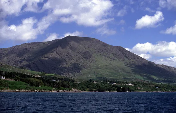
Overview
Hungry Hill (Irish: Cnoc Daod) is a mass of shale and crag in the Caha Mountains, at the western end of the Beara Peninsula above Bantry Bay. Below its eastern face, the twin lakes Coomadavallig and Coomarkane spill over the Mare’s Tail, a cascade that is at its best after heavy rain. Standing stones are scattered on the slopes to the south-east. The mountain has steep crags and exposed upland. Keep out of private ground unless you have permission.
Name, history and folklore
The Irish name Cnoc Daod translates roughly as ‘hill of the tooth’ or ‘hill of the jaw’, which suits a peak this jagged and notched. Older anglicisations include Knockdhead and Knockday. Local tradition speaks of the Bun Daods, a family who once lived at the base of the mountain and tended the standing stones on the south-eastern flank.
The English name carries a darker note. Asked why it’s called Hungry Hill, locals have long said the mountain is ‘hungry for bodies’, a warning born of its technical ground and quick-changing weather. That mood caught Daphne du Maurier, who used the peak as the title and setting of her 1943 novel, in which it metaphorically swallows successive generations of the Broderick family, loosely drawn from the Irish ancestry of her friend Christopher Puxley. Irish folklore also plants the character Daniel O’Rourke at the foot of the hill.
Walking in the area
There is no marked visitor route to the summit, and the ground is trackless in places, with steep shale outcrops, narrow rock bands and boggy plateaux. Keep out of private ground unless you have permission.
For a marked walk on Beara, use the Beara Way guide from Sport Ireland and choose a section that suits you. Check the forecast and trail notices, and keep to the waymarks.
Navigation and safety
- Visibility is critical: the upland here should never be attempted in mist. Navigation errors are common when you can’t follow a direct line, and the rock turns dangerously slippery when wet.
- Essential gear: sturdy boots, waterproofs, a headtorch and a reliable map with a compass. Mobile signal can be unreliable in the hills.
- Weather: winds on exposed ground can be sharp even in summer. Pack a windproof layer and aim for a clear day.
- Tell someone: let someone know your route and expected return time before you set off, carry a whistle, and check the Met Éireann forecast for the Beara area.
Nearby
Beyond the hill, the Beara Peninsula is good cycling and walking country, and Adrigole harbour is a sheltered spot on the coast. Further west, the Allihies Copper Mines preserve a well-kept 19th-century mining complex. The Healy Pass crosses the Caha range nearby, and Glengarriff and Castletownbere are the nearest towns for supplies. Public transport to Beara is sparse, so check current services before you travel.
On a clear day the views from Beara reach out towards Fastnet Rock, Cape Clear and the Skelligs. If the cloud is down on the tops, save the hills for another day.