Lakes, Rivers & Waterfalls in County Galway

Lough Corrib and the water that feeds it account for a good half of this page. Oughterard sits where the Owenriff meets the lake, 26 km out the N59 from Galway, and is the chief angling centre on it. Annaghdown, on the eastern shore, holds an Augustinian abbey, a bishop’s palace and a friary, all free to wander. Cornamona and Clonbur are Gaeltacht villages in Joyce Country, Clonbur on the narrow neck of land between Corrib and Lough Mask, while the Bealnabrack drains the Maam Valley into the lake and gives free wild trout fishing from the jetties at Maam Bridge.

West of there the water lies in valleys and takes a drive to reach. Ballynahinch Lake runs about 4 km below the Twelve Bens with Benlettery filling the view, and the castle owns the fishing and most of the southern shore. Lough Inagh sits between the Bens and the Maumturks with the R344 running its length; Lough Nafooey, near Leenane, is a near-rectangular glacial lake with a rare freshwater sandy beach at its western end. Delphi Valley holds three lakes under Mweelrea.

The east of the county is a different sort of visit. Loughrea’s Blue Flag lake is a short walk from the town centre, Lough Derg’s western shore is Galway’s share of the Shannon, and in the city the Corrib covers six kilometres from lake to bay.

13 of 17 shown — tap a pin for the place.

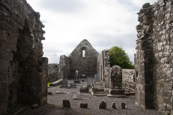
Annaghdown Abbey of St. Mary de Portu Patrum Nave 2010 09 12
Annaghdown Abbey of St. Mary de Portu Patrum Nave 2010 09 12 Andreas F. Borchert / Wikimedia Commons / CC BY-SA 4.0

Annaghdown – abbeys on Lough Corrib

Annaghdown, galway

On the eastern shore of Lough Corrib, Annaghdown holds one of Connacht's most complete medieval monastic sites: the Augustinian Abbey of St Mary, a bishop's palace and a Premonstratensian friary, all free to wander. Down at the pier, a stone marks the 1828 drowning that Antoine Ó Raifteiri turned into one of Irish poetry's great laments.

🌳 Outdoor
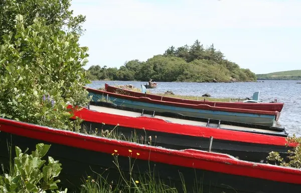
Boats and fishing on Lough Corrib - geograph.org.uk - 388530
Boats and fishing on Lough Corrib - geograph.org.uk - 388530 Oxana Maher / Wikimedia Commons / CC BY-SA 2.0

Cornamona – Lough Corrib Gaeltacht village

Cornamona, galway

Corr na Móna (Cornamona) is an Irish-speaking village on the north shore of Lough Corrib, in Joyce Country. It's best known for the lough's wild brown trout – no licence required – but it's also worth the mile out to the Corr na Móna viewpoint on the R345 for the view across the islands. The village stood in for rural Galway in the 2021 film Foscadh.

🌳 Outdoor
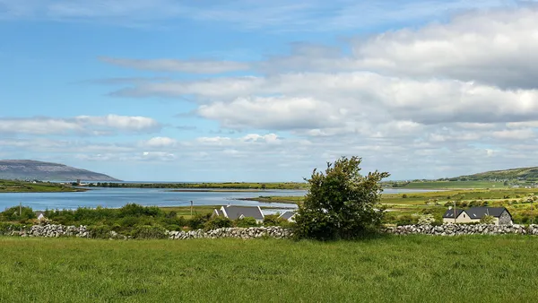
Galway Bay and Cappanawalla, Co. Clare (506313) (26786044752)
Galway Bay and Cappanawalla, Co. Clare (506313) (26786044752) Robert Linsdell from St. Andrews, Canada / Wikimedia Commons / CC BY 2.0

Galway Bay

West coast of Ireland, galway

Galway Bay runs about 50 km along the west coast, with County Galway to the north and the limestone Burren of County Clare to the south, and the Aran Islands guarding its mouth. You experience it in pieces: a sunset on the Salthill promenade, a ferry out to the Aran Islands, a Blue Flag beach in Spiddal, or the birdlife of its protected mudflats and turloughs.

🌳 Outdoor 🅿️ Free Parking
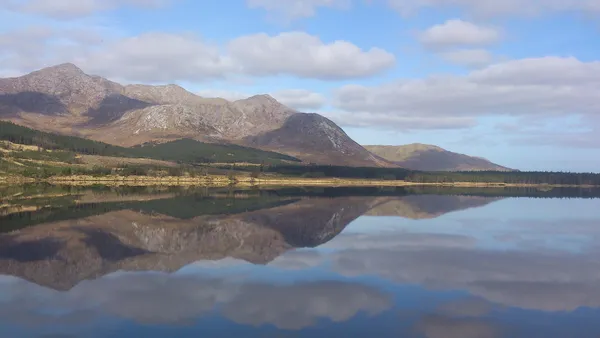
Bencorr from Lough Inagh, Connemara, Ireland
Bencorr from Lough Inagh, Connemara, Ireland Maria Hynes / Wikimedia Commons / CC BY-SA 4.0

Lough Inagh – Connemara salmon lake

Inagh Valley, galway

Lough Inagh lies in a valley between the Twelve Bens and the Maumturks, its still water throwing back the peaks on a calm day. It is a working salmon and sea-trout fishery, run from the lodge on its shore, and the R344 alongside it is one of the finest short drives in Connemara. Come for the fishing, the walking, or just the view from a lay-by.

🌳 Outdoor 🐕 Dogs Welcome
Lough Nafooey, or Loch Na Fooey, Connemara, Co Galway
Lough Nafooey, or Loch Na Fooey, Connemara, Co Galway Courtesy Joyce Country and Western Lakes Geopark

Lough Nafooey – Connemara volcano lake

Leenane, galway

Lough Nafooey is a near-rectangular glacial lake in a steep valley on the northern edge of Connemara, hemmed by the Maumturk and Partry mountains. The hills around it are the eroded roots of a volcano active 490 million years ago, and its western end holds one of Ireland’s rare freshwater sandy beaches.

🌳 Outdoor 🅿️ Free Parking 🐕 Dogs Welcome
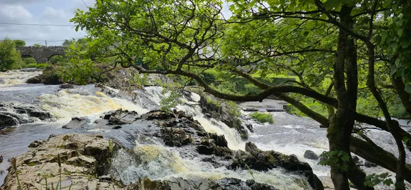
IRL 2025, Clifden; Owenglin River, June 2025 Republic of Ireland photographs (02)
IRL 2025, Clifden; Owenglin River, June 2025 Republic of Ireland photographs (02) Qwertzu111111 / Wikimedia Commons / CC BY-SA 4.0

Owenglin River – Clifden Falls in spate

Clifden, galway

The Owenglin comes off the Twelve Bens and drops through the centre of Clifden, where a waterfall reckoned at around 15 feet gives expert paddlers a Grade V line when the river is in flood. Most of the year it is a quieter thing – a walking river with salmon and sea trout, and the climb to the D'Arcy Monument above it.

🌳 Outdoor

Questions people ask

Which of these can I reach without a car?
The River Corrib is walkable through Galway city, from the Salmon Weir to the bay. Oughterard has regular buses from Galway and the lake is at the village. Loughrea's lake sits a short walk from the town centre. The Connemara valley lakes all need a drive.
Where do most of these places cluster?
Around Lough Corrib. Oughterard, Annaghdown, Cornamona, Clonbur and the Bealnabrack at Maam Bridge all sit on its shores or its feeder rivers, and the River Corrib carries the lake down into Galway city. The Connemara valley lakes form a second, more scattered group to the west.
Where can I fish for free?
The wild brown trout of Lough Corrib need no licence, and Cornamona is a good base for that. The Bealnabrack River is free to fish from the jetties at Maam Bridge. Ballynahinch and Lough Inagh are managed salmon and sea-trout fisheries run from the castle and lodge.
Is there anywhere here to swim?
Loughrea's lake carries a Blue Flag and has two diving piers used in summer. Lough Nafooey has one of Ireland's rare freshwater sandy beaches at its western end. On the coast, Spiddal on Galway Bay has a Blue Flag beach.
How do I get to An Loch Mór on Inis Oírr?
It is on the road out to the Plassey shipwreck, about a 20-minute walk or 10-minute cycle from the pier after the ferry over. It is a quiet stop rather than a headline sight, so pair it with the wreck on the same road.

← All things to do in County Galway

Book tours & tickets

Powered by GetYourGuide

We may earn a commission if you book through this link, at no extra cost to you.

Book tours, skip-the-line tickets and day trips with GetYourGuide. Free cancellation on most experiences.

See tours & tickets in County Galway →
Advertisement